Long baseline acoustic positioning system
[4] This compares to SBL and USBL systems with shorter baselines where ranging disturbances of a given amount can result in much larger position errors.
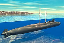
The search and inspection of the lost nuclear submarine USS Thresher by the U.S. Navy oceanographic vessel USNS Mizar in 1963 is frequently credited as the origin of modern underwater acoustic navigation systems.
However, its capability also included seafloor transponders, which in conjunction with early navigation satellites supported station-keeping with a precision of about 300 feet, considered remarkable at the time.
[8] By the mid-1960s and possibly earlier, the Soviets were developing underwater navigation systems including seafloor transponders to allow nuclear submarines to operate precisely while staying submerged.
[9] Besides navigating through canyons and other difficult underwater terrain, there was also a need to establish the position of the submarine prior to the launch of a nuclear missile (ICBM).
If the enemy were to knock out the GNSS satellites, the submarine could rely on the covert transponder network to establish its position and program the missile's own inertial navigation system for launch.