Subdivisions of Egypt
[9] These 'cities' are represented in the local administration hierarchy as qisms affiliated to the nearest city proper (See for example Badr, Shorouk and New Cairo).
While NUCA is legally obliged to transfer these communities to mainstream local administration once they are developed, none have been since its inception in 1979.
[14] Before the 1952 Egyptian revolution, state penetration of the rural areas was limited by the power of local notables.
Under Nasser, land reform reduced those notables' socioeconomic dominance, and the peasants were incorporated into cooperatives which transferred mass dependence from landlords to the government.
The district police station balanced the notables, and the system of local government (the mayor and council) integrated them into the regime.
[15] At each level, there was a governing structure that combined representative councils and government-appointed executive organs headed by governors, district officers, and mayors, respectively.
The coercive backbone of the state apparatus ran downward from the Ministry of Interior through the governors' executive organs to the district police station and the village headman.
[15] Sadat took several measures to administratively decentralize power to the provinces and towns, with limited fiscal and almost no political decentralisation.
Governors acquired more authority under Law 43/1979,[1] which reduced the administrative and budgetary controls of the central government over the provinces.
Thus, officials in Upper Egypt often bowed to the powerful Islamic movement there, while those in the port cities struck alliances with importers.
[17] After Mubarak was deposed by the popular uprising of January 2011, parliament and local councils were dissolved pending the writing of a new constitution.
[4] However, till the end of 2022, it has not been implemented as the government has drawn out the process of drafting a new local administration law leaving LPC seats vacant for over a decade.
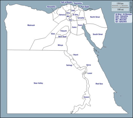
There are also unorganized areas in the Alexandria, Aswan, Asyut, Beheira, Beni Suef, Cairo, Dakahlia, Damietta, Faiyum, Giza, Ismailia, Kafr El Sheikh, Luxor, Minya, Port Said, Qalyubia, Qena, Sharqia, Sohag, and Suez governorates.