Marshall, Arkansas
Marshall serves as a hub for area tourism including camping, floating, hiking, bicycling and Dark Sky viewing.
In 1968 Don Dickson discovered lighter “heat treated” flint points at Calf Creek near Snowball.
A year after the Louisiana Purchase, Congress began efforts to remove all tribes west of the Mississippi.
By 1810, at the urging of the Secretary of War, large groups of Cherokees voluntarily moved to Arkansas and immediately found themselves fighting with the Osage who claimed this area as their hunting grounds.
(He was the Grandson, and name sake, of the great Chief of the Shawnee Nation during the American Revolutionary War.)
After World War I, a complex series of events combined to undermine the previous decades growth.
Following World War II Marshall was the primary trade center for service and retail for most of Searcy County serving as the hub for the timber, cattle, and other agricultural industries.
By the late 1960s the commercial strawberry industry was moving to California and Texas, general retail was being captured by national companies like Wal-Mart, and improved highway systems allowed people to travel to larger towns for all goods and services.
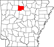
Marshall is located at 35°54′36″N 92°38′11″W / 35.909950°N 92.636370°W / 35.909950; -92.636370[4] situated in the Ozarks at the base of the northern escarpment of the rugged Boston Mountains.
According to the United States Census Bureau, the city has a total area of 2.6 square miles (6.7 km2), all land.
The climate in this area is characterized by hot, humid summers and generally mild to cool winters.
Located on US Highway 65 and near the Tyler Bend Visitor Center for the Buffalo National River, the city serves a large volume of traffic for travel and tourism.
The Searcy County Veteran's Memorial Hall has an extensive military museum focused on local service men and women.
It features photos and information about hundreds of Searcy County residents from every US theater of action from present all the way back to the War of 1812.
The scenic overlook one mile south of town on Devil's Backbone Mountain offering a panoramic view of north central Arkansas.
The Buffalo National River and Tyler Bend Visitor Center[11] located 10 1⁄2 miles to the north provides a variety of park and recreational activities including hiking, swimming, canoeing, horseback trails, camping and interpretive programing.
Motorcycling trails include the 57-mile Bear Creek Grow[12] and the 64-mile Leslie Lasso,[13] two routes that combine into one ride called the Growl-Lasso!
The airport has a Precision Approach Path Indicator, (PAPI) and features a 4003′ x 75′ lighted (MIRL) runway, runway strength 12,500 SW, rotating beacon, 120′ x 150′ hangar, 18′ side walls, 60′ stack doors, 8′ loading dock, and a large, paved apron.
The Marshall High girls basketball team won back-to-back Class AAA state championships in 2007 and 2008.
[19] In the 2019 rankings of U.S. News & World Report, Marshall High School was recognized as a bronze medal recipient.
This Youth Center provides free access to nutrition, supervised games, crafts, music and tutoring.