Osceola, Arkansas
Occupying an important location on the river, the city's economy grew as steamboat traffic increased.
During the prehistoric period, Osceola and Mississippi County were largely swampland, with dense forest cover.
Initial white visitors to the area were speculators, hunters, and outlaws, but the remote region remained sparsely populated by settlers.
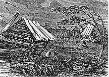
The results were widespread soil liquefaction and a change in geography that produced "sunken lands", which were sandy berms of silt and sediment disturbed by the earthquakes.
By this point, the combination of abundant timber as an obvious economic asset and easy access to shippers and travelers along the river began driving growth in the region.
[7] The Plum Point community had developed into a successful waypoint on the Mississippi as well as a hub for the timber required to power the steamboats that had become common on America's waterways.
[8] Settlers began to explore the uses for the fertile soils now ripe for row agriculture following clearing of the dense forests.
It became apparent that the soil supported cotton extremely well, which was already a popular crop elsewhere in the South due to heavy European demand driven by the Industrial Revolution and resulting high market prices.
Osceola saw thousands of Union troops enter the area in 1862 in preparation to assault Fort Pillow and Memphis.
Osceola itself was mostly subject to raids from both armies and guerrilla warfare that resulted in burning, pillaging and damage throughout the city.
Following the Civil War, race relations began to tighten between plantation owners who had lost the slave labor that fueled their successful plantations, poor whites who were suddenly in competition for work and social status with freedmen, and the former slaves who continued to face deprivation of their rights despite the war's outcome.
Whitecapping by the Ku Klux Klan and other groups promoted a lawless atmosphere in Mississippi County.
The Mississippi County Historical Center is located in a 1904 building that once housed a dry goods store.
The Tennessee border is less than 1,000 feet (300 m) to the east of the levee, in a narrow channel of the Mississippi separated from the main river by Island Number 30.
According to the United States Census Bureau, the city of Osceola has a total area of 9.4 square miles (24 km2), all land.
[8] Steamboats allowed Osceola to continue to leverage its position on the river as a shipping port for timber and cotton from the surrounding fields.
A municipally-owned entity named Osceola Municipal Light & Power houses the Electric, Street and Sanitation, and Water & Wastewater departments.
Osceola's source for drinking water is the Wilcox Aquifer, located 1,500 feet (460 m) beneath the city.
Three sites throughout town pump raw water from this aquifer to the ground surface, where air is added to lower the iron content.
At the WWTF, influent wastewater is treated in faculative lagoons in accordance with the city's NPDES permit administrated by the Arkansas Department of Environmental Quality (ADEQ).
The plant occupies 2.6 million square feet or 60 acres and is the largest employer in Mississippi County.


