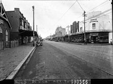
Mascot, New South Wales
Mascot is located 7 kilometres south of the Sydney central business district and is one of the administrative centres of the Bayside Council.
Residents wanted the area to have an individual identity and a referendum was held in 1911 to choose between Ascot, and Booralee.
[4][5] In the early 1970s a large meeting of residents successfully requested that the NSW Builders Labourers Federation place a ban on the construction of town-house type dwellings if there was not sufficient green area retained around them.
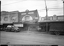
[6] Mascot has a number of heritage-listed sites, including: 1024 Botany Road: Botany Water Reserves[7] and General Holmes Drive: Sewage Pumping Station 38[8] Mascot has a mixture of residential, commercial and industrial areas.
Mascot Fire Station is located in Coward Street, beside the City of Botany Bay Council Chambers.
Mascot is serviced by a number of bus routes, which are operated by Transdev John Holland and Transit Systems.
The Sydenham to Botany branch of the Metropolitan Goods railway line passes through the suburb and includes a yard in Mascot.
improvements to Kingsford-Smith Airport have resulted in the creation of a bicycle path between Mascot (Coward Street) and the M5 East Freeway at Arncliffe.
Other bike paths pass through Mascot to Botany Bay, the University of New South Wales and the Sydney CBD.
[1] Mascot is in the safe Labor federal electoral division of Kingsford Smith, which has been held by Matt Thistlethwaite since 2013.