Maugerville
The story of its establishment demonstrates how colonial officials in Halifax, Nova Scotia, clandestinely dispossessed the Wəlastəkwiyik (Maliseet) indigenous peoples from their territorial lands without their knowledge, in violation of earlier Indian-British Treaties and the Royal Proclamations of 1761 and 1763.
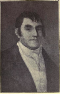
[8] The group commissioned Israel Perley, a young surveyor, along with twelve other men to travel to the Saint John River to explore settlement opportunities.
[9] Given the favorable report and in spite of the Royal protection of Wəlastəkwiyik territory, in 1761 Captain Francis Peabody petitioned and was granted authority by the Government of Nova Scotia to survey a twelve-square mile township on the Saint John River, "wherever it might be found fit for improvement.
"[10] On May 19, 1762, Captain Francis Peabody, Jacob Barker and Israel Perley arrived at the present day city of Saint John and after deeming a number of properties near the harbor unfit for settlement, travelled ninety miles up the River to St Anne’s point.
[11] However, Wəlastəkwiyik from a Native village just above St Anne’s, with the help of an interpreter, advised the survey party that "they were trespassers on their rights; that the country belonged to them and unless they retired immediately they would compel them to do so.
[18] In their quest to find productive farmland Peabody and his fellow settlers were attracted to the immense alluvial plain on the east side of the Saint John River.
The rich alluvial soils, free of stones, were exceedingly fertile and composed of fine silt laid down over thousands of years by the annual silt-bearing Saint John River freshet.
Their petition emphasized their previous service to the King as American militia in the French and Indian War, the fact they had sold their farms in New England and at their own expense relocated families and livestock to the Saint John River settlement.
[14] In December 1763 their petition was granted with King George III confirming: "The Governor of Nova Scotia is ordered to cause the land upon which they are settled to be laid out in a Township consisting of 100,000 acres, 12 miles square, one side to front on the river.
By December 1766, a government census revealed there were 261 people in the Maugerville community who were keen to fulfill the obligations of their grants as they possessed 78 oxen and bulls, 145 cows, 156 young cattle and 10 horses.
[23] Charles Morris revisited the settlement in 1767, commenting that in spite of never ploughing the land, they were able to grow 20 bushels of corn and wheat per acre simply by harrowing their fields.
[26] Lumbering supplied white and red oak staves for both the lime burning business in Saint John and the rum and molasses trade in the West Indies.
[31] The unofficial settlement of the Township of Maugerville in 1762 not only marked the first English community on the Saint John River but also the initiation of a settler-driven theft of Indian territories by the government of Nova Scotia.
"[16] Similarly, in contravention of the provisions of the 1763 Proclamation, newly appointed Lieutenant-Governor Montagu Wilmot, in 1764-1765, continued land grants to British settlers without either informing Crown officials in England or Aboriginal peoples in Nova Scotia.
[34] By October 1765, colonial settler imperialism had orchestrated the theft of three million acres of Indigenous territory from Native peoples in Nova Scotia, half of that being stolen from the Wəlastəkwiyik along the Saint John River, including the township of Maugerville.
Led by Chief Ambroise Saint Aubin, the Maliseets immediately began to plunder the British in the community, burning some of their homes and taking others prisoner back to New England.