Meteorological history of Hurricane Luis
Hurricane Luis maintained wind speeds of 130 mph (210 km/h) for nearly two days and developed a symmetrical structure with a well-defined 46 mi (74 km) wide eye.
Early on September 11, Luis made landfall on the Avalon Peninsula as a strong Category 1 hurricane with winds of 90 mph (145 km/h).
On August 26, the National Hurricane Center (NHC) began monitoring a tropical wave between the western coast of Africa and the Cape Verde Islands.
Convective activity associated with the low became increasingly organized, and at around 1200 UTC on August 27, the NHC classified the system as Tropical Depression Thirteen; at the time, it was located approximately 255 miles (410 kilometres) south-southeast of Praia, Cape Verde.
[3] Tracking nearly due west in response to an anticyclone to the north and an area of moderate wind shear, the depression was forecast to slowly strengthen over the next several days.
[4] Early on August 29, satellite intensity estimates of maximum sustained winds within the depression reached 40 mph (65 km/h), indicating that it had intensified into a tropical storm.
[2][15] Early on September 3, satellite intensity estimates indicated that the storm strengthened slightly, attaining its peak winds of 140 mph (225 km/h) at around 0600 UTC.
[17] When Luis was about 690 mi (1,110 km) east of the Lesser Antilles, a Hurricane Hunter reconnaissance flight into the storm confirmed satellite intensity estimates.
[2] A strong mid- to upper-level low located over the Gulf of Mexico was forecast to steer the hurricane in a general northeastern direction.
[23] From September 6 to 7, a ship named the Teal Arrow sailed directly into the center, encountering wind gusts of up to 145 mph (235 km/h) and seas to 50 feet (15 m).
[24] The winds failed to intensity; however, the central pressure continued to decrease until 0000 UTC on September 8, when it fell to 935 mbar (27.6 inHg), the lowest recorded during the storm's existence.
[31] During the afternoon of September 10, the central pressure of the storm decreased to 961 mbar (28.4 inHg) but sustained winds did not exceed 90 mph (145 km/h) according to the NHC.
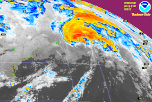
[2][32] While tracking over Newfoundland, cold, dry air became entrenched in Luis's circulation and the system began to merge with the approaching trough.
The NHC issued their final advisory on Hurricane Luis at 0900 UTC on September 11 as it tracked nearly 65 mph (105 km/h) to the northeast and transitioned into an extratropical cyclone.
[33] The extratropical remnants persisted for 30 more hours over the North Atlantic Ocean before being absorbed by the trough near the southern coast of Greenland late on September 12.