Mossel Bay
Although it is today best known as the place at which the first Europeans landed on South African soil (Bartolomeu Dias and his crew arrived on 3 February 1488), Mossel Bay's human history can – as local archaeological deposits have revealed – be traced back more than 164,000 years.
By the time the Portuguese explorer Vasco da Gama reached the area in 1497, the Bay had been marked on the maps as Aguada de São Brás, the Watering Place of St Blaize - whose feast is celebrated on 3 February.
He left an account of the disaster hidden in an old shoe which he suspended from a milkwood tree (Sideroxylon inerme) near the spring from which Dias had drawn his water.
João da Nova erected a small shrine near the Post Office Tree, and although no traces of it remain, it is considered the first place of Christian worship in South Africa.
[5] Although the Dutch governor of the Cape Colony, Jan de la Fontaine, visited Mossel Bay and erected a possession stone here in 1734, the first permanent European building – a fortress-like granary – was built only in 1787.
From the earliest days of the Dutch settlers, Mossel Bay acted as the major port serving the Southern Cape region and its hinterland, the arid Klein Karoo (or Little Karoo), and during the ostrich feather boom of the late 19th and early 20th centuries, more than 800,000 kg of feathers were exported through the port every year – which may have been the impetus that led to the construction of the first breakwater in 1912.
Whilst the Port and the Refinery have, of course, had a major influence on the development of Mossel Bay, they have always worked in tandem with the growth of tourism and general commerce so that the town now boasts a balanced and vibrant economy.
South Africa installed its first democratically elected government in 1994, which brought about sweeping changes in the structure of local government throughout the country - one of the results of which was that Mossel Bay merged with the smaller, neighbouring villages of Friemersheim, Great Brak River and Herbertsdale to form the present-day Mossel Bay Local Municipality in December 2000.
Prevailing winds are westerly in winter (May - August) and easterly in summer (September - April), and rarely reach storm- or gale-force strength.
Mossel Bay straddles the Cape St Blaize peninsula (which rises to an average height of 96 metres), and spreads out along the sandy shores of the Indian Ocean, eastwards towards the town of George.
To the east, the land slopes upwards towards the wave-cut platform (average elevation 245 metres) that characterises the more lush all-year-round rainfall area of the Garden Route.
However, with good roads, modern vehicles and the development of inland accommodation, the broader environment of the area (including the Outeniqua Mountains to the north, and large stands of fynbos, or Cape macchia, to the west) is now vital to the tourism economy.
[12] In addition, the history of the town (Mossel Bay was the site of the first contact between European explorers and indigenous people), and its cultural attractions are important features.
Originally designed to celebrate the arrival of Bartolomeu Dias and his crew on 3 February 1488, and to protect the "Post Office Tree", the Complex now offers a wider look at the history of Mossel Bay from environmental, archaeological, and cultural perspectives.
The summer holiday season (from about mid-December to mid-January) is the busiest time of the year, and, in December 2010, the Municipality estimated that the town provided accommodation for between 50,000 and 60,000 holidaymakers per night during this period.
The PetroSA (Petroleum, Oil and Gas Corporation of South Africa Pty Limited) Refinery – which was commissioned as Mossgas in 1987 – is situated about 13 km to the west of the town's central business district.
It produces 36,000 barrels (5,700 m3) per day (bbl/d) – a crude oil equivalent of 45,000 bbl/d (7,200 m3/d) – using the Fischer–Tropsch process of converting natural gas (which is piped from offshore fields via PetroSA's FA Platform).
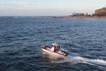
It caters mostly for the oil industry (off-shore gas was discovered in late 1980s), and for a small fishing fleet, and is owned and managed by the Transnet National Ports Authority,[14] which falls directly under South Africa's Department of Public Enterprises.
The Mossel Bay Archaeology Project (MAP) has shown that the Southern Cape Coast was most probably the point where modern behaviour first emerged about 164,000 years ago.
The Mossel Bay Archaeology Project was created to examine the ancient middens in the Pinnacle Point Caves, most of which lie about 12 km east of Cape St Blaize.
The discovery was made during routine archaeological surveys conducted prior to the development of the Pinnacle Point Beach and Golf Resort,[16] and excavations began in the year 2000 under the leadership of Professor Curtis Marean[17] (a palaeoanthropologist with the Institute of Human Origins at the Arizona State University), and by Dr. Peter Nilssen, of the Iziko South African Museum.
The Project focuses on a series of caves cut into the sea-facing cliffs on the southern boundary of the Pinnacle Point Beach and Golf Resort,[18] which were occupied between 170,000 and 40,000 years ago by Middle Stone Age people.
The Cave has revealed deposits dating from about 200,000 years ago to the pre-colonial period, during which time middens were laid down by herders of the San or Khoekhoen people.
The rock art sites surrounding Mossel Bay are generally located on private land, and are therefore only accessible to the public in the company of registered guides, who will ensure that the integrity of the pieces remains intact.
Municipality (3) – A new coat of arms was registered at the Bureau on 20 February 1998: Per saltire, in base grady, Azure and Or, in chief two whales naiant in pale and in base a fess nowy of two Karoo gable houses, Argent, the doors Azure, the lower edge wavy; dexter an aloe Vert flowered Gules and sinister a 15th century Portuguese caravelle proper, the sail charged with a cross paty, Gules.