Nagorno-Karabakh
Representatives from the two sides held numerous inconclusive peace talks mediated by the OSCE Minsk Group regarding the region's disputed status, with its majority-Armenian population over time variously advocating either for Artsakh's independence from both states or for its integration into Armenia.
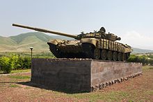
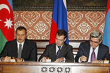
[8][9][10][11] The war ended on 10 November 2020 when a trilateral ceasefire agreement was signed between Azerbaijan, Armenia, and Russia, under which all the remaining occupied territories surrounding Nagorno-Karabakh were formally returned to Azerbaijani control.
[25] Nagorno-Karabakh falls within the lands occupied by peoples known to modern archaeologists as the Kura-Araxes culture who lived between the two rivers Kura and Araxes.
[29] According to the prevailing western theory, these natives intermarried with Armenians who came to the region after its inclusion into Armenia in the 2nd (or possibly earlier, the 4th) century BC.
[34] The ruins of the ancient Tigranakert, located 50 km (30 mi) north-east of Stepanakert, are being studied by a group of international scholars.
Overall, Mesrop Mashtots made three trips to Artsakh and Utik, ultimately reaching pagan territories at the foothills of the Greater Caucasus.
[41] According to other sources, Sahl Smbatian "was of the Zamirhakan family of kings," and in the year 837–838 he acquired sovereignty over Armenia, Georgia, and Albania.
[45] Initially Dizak in southern Artsakh also formed a kingdom ruled by the ancient House of Aranshahik, descended from the earliest Kings of Caucasian Albania.
According to Abu Bakr Tihrani, during the period of Jahan Shah (1438–1468), the ruler of Kara Koyunlu, Piri bey Karamanli held the governorship of Karabakh.
[51] However, according to Robert Hewsen, the Russian Empire recognized the sovereign status of the five princes in their domains by the charter of Emperor Paul I dated 2 June 1799.
Karabakh (including modern-day Nagorno-Karabakh), became a protectorate of the Russian Empire by the Kurekchay Treaty, signed between Ibrahim Khalil Khan of Karabakh and general Pavel Tsitsianov on behalf of Tsar Alexander I in 1805, according to which the Russian monarch recognized Ibrahim Khalil Khan and his descendants as the sole hereditary rulers of the region.
[67][68] After the October Revolution, Karabakh became part of the Transcaucasian Democratic Federative Republic, but this soon dissolved into separate Armenian, Azerbaijani, and Georgian states.
The British command provisionally affirmed Khosrov bey Sultanov (appointed by the Azerbaijani government) as the governor-general of Karabakh and Zangezur, pending a final decision by the Paris Peace Conference.
This unprecedented action by a regional Soviet brought out tens of thousands of demonstrations both in Stepanakert and Yerevan, but Moscow rejected the Armenians' demands.
The first direct confrontation of the conflict occurred as a large group of Azeris marched from Agdam to the Armenian populated town of Askeran.
[81] Many survivors from the Azerbaijani side found shelter in 12 emergency camps set up in other parts of Azerbaijan to cope with the growing number of internally displaced people due to the first Nagorno-Karabakh war.
[96] At that stage, for the first time during the conflict, the Azerbaijani government recognized Nagorno-Karabakh as a third party in the war and started direct negotiations with the Karabakh authorities.
[106] On 26 January 2016, the Parliamentary Assembly of the Council of Europe (PACE) adopted Resolution 2085, which deplored the fact that the occupation by Armenia of Nagorno-Karabakh and other adjacent areas of Azerbaijan creates humanitarian and environmental problems for the citizens of Azerbaijan, condemned ethnic cleansing against Azerbaijanis and Assembly requested immediate withdrawal of Armenian armed forces from the region concerned.
[7] The United Nations strongly condemned the conflict and called on both sides to deescalate tensions and resume meaningful negotiations without delay.
[8][9][10][11][115] In December 2022, Azerbaijanis claiming to be environmental activists blocked the Lachin corridor, the sole road connecting Nagorno-Karabakh to Armenia and the outside world.
[118][119][120][121][122] Limited traffic had been conducted by Russian peacekeepers and the International Committee of the Red Cross to transport patients in need of medical care and provide humanitarian supplies.
[123][124] However, starting on 15 June 2023, Azerbaijan intensified the blockade, blocking all passage of food, fuel, and medicine from the Red Cross and the Russian peacekeepers through the Lachin corridor.
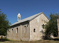
The major cities of the region are Stepanakert, which once served as the capital of the unrecognised Nagorno-Karabakh Republic, and Shusha, which lies partially in ruins.
[136] Nagorno-Karabakh's environment vary from steppe on the Kura lowland through dense forests of oak, hornbeam, and beech on the lower mountain slopes to birchwood and alpine meadows higher up.
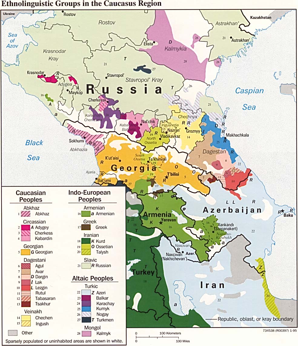
[137] Historically, the inhabitants of Nagorno-Karabakh — then part of the province of Artsakh — were confirmed by Ancient Greek and Roman sources "long before our era" to be Armenian.
[148] By 11 April 1920, some thirty villages in Nagorno-Karabakh had been "devastated" by Azerbaijani forces as a result of the uprising, leaving 25,000 homeless (including nearly 6,000 refugees from Shusha).
Whilst the region was a part of the Azerbaijan SSR, the Armenian share of the population dropped from 94.7 to 76.9 percent, whilst the Azerbaijani share of the population quadrupled from 5.1 to 21.5 percent[141] as a result of "migratory influx"[143] — indicative of the socio-economic difficulties local Armenians experienced under Soviet Azerbaijani leadership which led them to emigrate from Karabakh.
[143] According to historian Deon Geldenhuys, "[t]his was due to Baku's deliberate promotion of Azerbaijani settlement in Karabagh as part of a policy of 'cultural de-Armenization' of the region"; further adding that Azerbaijan "neglected the economic needs of the territory".
Cultural ties with Armenia were strangled in red tape in Baku, and a decision to make Armenian-language television available in the region was left unimplemented.
[81] During the Second Nagorno-Karabakh War, Azerbaijan regained control over the surrounding districts and southern parts of the former NKAO, thus displacing approximately 70,000 Armenians.


