Arava Stream
[citation needed] It is 89 km long, and in many parts, serves as the actual border between Israel and Jordan.
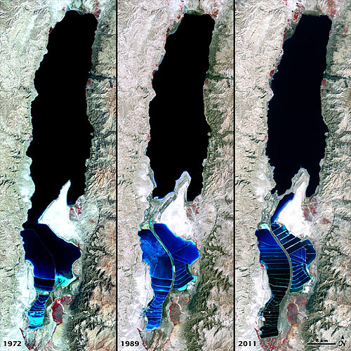
[4] After the Dead Sea basin was severed into the northern and southern parts, the area between them turned into dry seabed.
[4] The banks of the Arava Stream (and the brine channel) had become eroded in the area, and the continued erosion endangers the stability of the evaporation ponds.
Also the seasonal floods of the stream present danger to the chemical plants in the Mount Sodom area.
[5] A correspondent of Kan 11 TV channel Oren Aharoni wrote a series of articles about the northern path of the Arava Stream and dubbed it a new "secret river" because it is mostly unknown to the general public.