Neighborhoods of Omaha, Nebraska
In the early decades after settlement the city expanded, building the Near North Side, Sheelytown (Irish immigrants), and housing districts throughout what is now Downtown Omaha.
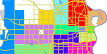
The boundaries of Omaha have changed significantly since its founding, with the city growing through subdivisions and annexations.
The original Mormon settlement in Florence, called Cutler's Park, predated the founding of Omaha in 1846.
[5] Located northwest of the city, it was a key stop along the Fremont, Elkhorn, and Missouri Valley Railroad in the early 1900s.
Carter Lake, Iowa, which was formerly on the eastern side of the Missouri River, today sits nestled into Nebraska.
Waterloo was once the world's largest shipper of seed corn, and was home of the Douglas County Fair for over 80 years.
Scriptown was a conspicuous development first platted in 1855 to award Nebraska Territory legislators for the votes for statehood.
The area was bound by downtown Omaha on the south and the Saratoga neighborhood on the north, 30th Street on the west and 16th Avenue on the east.
Created by historical German, Irish, Jewish, and African Americans, the community became a renowned center of Black culture in the United States in the 1920s.
The Saratoga community is the location of a historical town that boomed and busted within one year of its founding.
Also in the area is Kountze Place, a former suburban enclave of wealthy Omaha doctors, lawyers and businessmen.
Originally part of the township of East Omaha, the community was ceded to the State of Iowa after a contentious court battle in the late 1890s.
Located next to the Missouri River and the now-dry Florence Lake, Beechwood had its own school district and commercial area.
It includes Florence, the original Mormon settlement of Cutler's Park, which predates the founding of the City of Omaha; it was annexed in 1917.
The southwest part of North Omaha includes Benson, located near 60th and Maple Streets.
The Gold Coast neighborhood, including St. Cecilia Cathedral, has several important architectural gems, as well as several historical parks.
The black neighborhood in Omaha was clearly defined by redlining practices used by real estate agents, and was identified as the Near Northside.
[8] Kountze Place, the second Gold Coast, Dundee and other Omaha neighborhoods and blocks had racially or ethnically restrictive housing covenants.
Further restrictions on conveyance (rental, lease, sale, transfer) were often included, effectively defining most of the neighborhoods in Omaha during the first decades after establishment.
After more than a decade of pressure from the Urban League and others, the City of Omaha adopted an Open Housing Ordinance in 1969.
The central area of Omaha, immediately west of downtown and extending to 72nd Street, is home to several of historically significant neighborhoods.
Gifford Park, Morton Meadows, Gold Coast and Country Club are important to the history of Omaha.
Located in West Omaha is Boys Town, an incorporated village near 132nd and Dodge Streets and is home to the famous institution of the same name.
Also on the fringe of the city is Chalco, an unincorporated area southwest of Omaha in northern Sarpy County that forms its own neighborhood.
[10] Spring Lake and Deer Park are also located in the area, as well as Field Club and the Omaha Quartermaster Depot Historic District.