Newfoundland (island)
By that classification, Newfoundland and its associated small islands have a total area of 111,390 square kilometres (43,008 sq mi).
The island was possibly visited by the Icelandic explorer Leif Erikson in the 11th century as a rest settlement when heading farther south to the land believed to be closer to the mouth of the St. Lawrence River called "Vinland".
The island was possibly visited by the Venetian navigator John Cabot (Giovanni Caboto), working under contract to Henry VII of England on his expedition from Bristol in 1497.
On 5 August 1583, Humphrey Gilbert claimed Newfoundland as England's first overseas colony under Royal Charter of Queen Elizabeth I, thus officially establishing a forerunner to the much later British Empire.
They were descendants of migrations of ancient prehistoric peoples across the High Arctic thousands of years ago, after crossing from Siberia via the Bering land bridge.
[21] The tribe is now typically considered extinct, but evidence of its culture is preserved in museums and historical and archaeological records.
This research estimated that the settlement dates to about the year 1000, and the site contains the earliest-known European structures in North America.
In 2021, an interdisciplinary team used the Miyake event of 993-994 as a benchmark in dendrochronology (tree-ring studies) to precisely determine that Vikings were present in L'Anse aux Meadows in Newfoundland in year 1021.
[28] Designated as a World Heritage Site by UNESCO, it is believed to be the Vinland settlement of explorer Leif Erikson.
(The Icelandic Skálholt map of 1570 refers to the area as "Promontorium Winlandiæ" and correctly shows it on a 51°N parallel with Bristol, England).
[29] About 500 years later, in 1497, the Italian navigator John Cabot (Zuan/Giovanni Caboto) became the first European since the Norse settlers to set foot on Newfoundland, working under commission of King Henry VII of England.
[30] After Cabot, the first European visitors to Newfoundland were Portuguese, Spanish, Basque, French and English migratory fishermen.
In 1583, when Sir Humphrey Gilbert formally claimed Newfoundland as a colony of England, he found numerous English, French and Portuguese vessels at St. John's.
In July 1596 the Scottish vessel the "William" left Aberdeen for "new fund land" (Newfoundland) and returned in 1600.
This, and other early attempts at permanent settlement failed to make a profit for the English investors, but some settlers remained, forming the very earliest modern European population on the island.
This settlement attracted a major migration of Irish Catholic immigrants to Newfoundland in the early eighteenth century.
The European immigrants, mostly English, Scots, Irish and French, built a society in the New World unlike the ones they had left.
But its geographic location and political distinctiveness isolated it from its closest neighbours, Canada and the United States.
Many were distant from larger centres of population and isolated for long periods by winter ice or bad weather.
Newfoundland and Labrador developed a wide variety of distinctive customs, beliefs, stories, songs and dialects.
[37][38] A unique vocabulary arose focused on the sea ice and weather of this isolated location and the native wildlife its residents relied upon for food and income.
Even now, when the rest of Canada celebrates the founding of the country on July 1, many Newfoundlanders take part in solemn ceremonies of remembrance.
In particular, the United States assigned forces to the military bases at Argentia, Gander, Stephenville, Goose Bay, and St.
The first flag to specifically represent Newfoundland is thought to have been an image of a green fir tree on a pink background that was in use in the early 19th century.
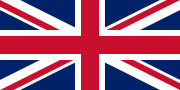
[46] On March 31, 1949, Newfoundland became a province of Canada but retained the Union Jack in legislature, still designating it as the "national" flag.
The St. John's census metropolitan area includes 12 suburban communities, the largest of which are the city of Mount Pearl and the towns of Conception Bay South and Paradise.
The Marble Mountain Ski Resort near Corner Brook is a major attraction in the winter for skiers in eastern Canada.
Other major communities include the following towns: Educational institutions include the provincial university, Memorial University of Newfoundland whose main campus is situated in St. John's, along with the Grenfell Campus in Corner Brook, in addition to the College of the North Atlantic based in Stephenville and other communities.
Locations on the extreme southeast of the island receive sufficient maritime influence to qualify as having a subpolar oceanic climate (Köppen Cfc).
The Terreneuvian Epoch that begins the Cambrian Period of geological time is named for Terre Neuve (the French term for Newfoundland).