Geography of Tasmania
Tasmania, the largest island of Australia, has a landmass of 68,401 km2 (26,410 sq mi) and is located directly in the pathway of the notorious "Roaring Forties" wind that encircles the globe.
Tasmania lies at similar latitudes to Te Waipounamu / South Island of New Zealand, and parts of Patagonia in South America, and relative to the Northern Hemisphere, it lies at similar latitudes to Hokkaido in Japan, Northeast China (Manchuria), the north Mediterranean in Europe, and the Canada-United States border.
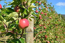
The Midlands located in the central east, is fairly flat, and is predominantly used for agriculture, although farming activity is scattered throughout the state.
The Tarkine, containing Savage River National Park located in the island's far north west, is the largest temperate rainforest area in Australia covering about 3,800 square kilometres (1,500 sq mi).
The presence of these mountain ranges is a primary factor in the rain shadow effect, where the western half receives the majority of rainfall, which also influences the types of vegetation that can grow.
A distinctive type of moorland found across the west, and particularly south-west of Tasmania, are buttongrass plains, which are speculated to have been expanded by Tasmanian Aboriginal burning practices.
On the West Coast Range and partially on Mount Field, Australia's only winter-deciduous plant, deciduous beech is found, which forms a carpet or krummholz, or very rarely a 4-metre tree.
Rainforest found in deep gullies are usually difficult to traverse due to dense understorey growth, such as from horizontal (Anodopetalum biglandulosum).
Emergent growth usually comes from eucalyptus, which can tower another 50 metres higher (usually less), providing the most common choice of nesting for giant wedge-tailed eagles.
When the land veered to the north-west at Eddystone Point,[10] he tried to keep in with it but his ships were suddenly hit by the Roaring Forties howling through Bass Strait.
At Flinders' recommendation, the Governor of New South Wales, John Hunter, in 1800 named the stretch of water between the mainland and Van Diemen's Land "Bass's Straits".
He reported that the strong south westerly swell and the tides and currents suggested that the island was in a channel linking the Pacific and southern Indian Ocean.
[15] Tasmania has a relatively cool temperate climate compared to the rest of Australia, spared from the hot summers of the mainland and experiencing four distinct seasons.
Other inland areas are much cooler, with Liawenee, located on the Central Plateau, one of the coldest places in Australia, ranging between 4 °C (39 °F) and 17 °C (63 °F) in February.
Winter maximums are 12 °C (54 °F) on average along coastal areas and 3 °C (37 °F) on the central plateau, as a result of a series of cold fronts from the Southern Ocean.
These soils are highly acidic and fix phosphate very effectively, but their extremely favourable physical properties make them extensively used for dairying, beef cattle and fodder crops.
They are mostly classified as "prairie soils" or "brown earths" and bear some resemblance to the chernozems of Russia and North America, although they are much lower in available phosphorus and somewhat acidic in the surface levels.
[38] Tasmania has extremely diverse vegetation, from the heavily grazed grassland of the dry Midlands to the tall evergreen eucalypt forest, alpine heathlands and large areas of cool temperate rainforests and moorlands in the rest of the state.
Nothofagus gunnii, commonly known as Australian beech, is Australia's only temperate native deciduous tree and is found exclusively in Tasmania.
Known colloquially as the Tasmanian tiger for the distinctive striping across its back, it became extinct in mainland Australia much earlier because of competition by the dingo, introduced in prehistoric times.
Owing to persecution by farmers, government-funded bounty hunters and, in the final years, collectors for overseas museums, it appears to have been exterminated in Tasmania.
[51] Controversy surrounds the decision in 2014 by the Abbott federal Liberal government to request the area's delisting and opening for resource exploration (before it was rejected by the UN Committee at Doha),[52] and the current mining and deforestation in the state's Tarkine region, the largest single temperate rainforest in Australia.