Nock Mountains
As westernmost part of the Gurktal Alps, the Nock Mountains are separated from the Low Tauern in the north, stretching as far as the Katschberg Pass (1,641 m (AA)) in the west, by the Mur River.
In the west, the rivers Lieser and Drau separate the Nock Mountains from the Ankogel Group of the High Tauern and from the Gailtal Alps.
South of Lake Ossiach they are adjoined by the lower Sattnitz range and the Klagenfurt Basin, another part of the Gurktal Alps.
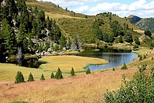
[4] The central area formed Nock Mountains National Park (German: Nationalpark Nockberge), established by the Carinthian state government on 1 January 1987.
The territory of 184 square kilometres (71 sq mi) was entirely located within the Carinthian part of the range, along the border with Salzburg and Styria, stretching from Krems and the Lieser Valley in the west to Reichenau in the east, and down to Bad Kleinkirchheim and Radenthein in the south.