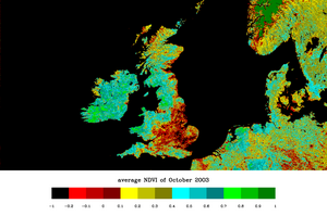
Normalized difference vegetation index
These are orbiting platforms embarking instruments specially designed to observe the Earth's atmosphere and surface with a view to improve weather forecasting.
This was later (1964 onwards) followed by the Nimbus satellites and the family of Advanced Very High Resolution Radiometer instruments on board the National Oceanic and Atmospheric Administration (NOAA) platforms.
These early sensors had minimal spectral resolution, but tended to include bands in the red and near-infrared, which are useful to distinguish vegetation and clouds, amongst other targets.
With the launch of the first ERTS satellite – which was soon to be renamed Landsat 1 – on July 23, 1972 with its MultiSpectral Scanner (MSS) NASA funded a number of investigations to determine its capabilities for Earth remote sensing.
One of those early studies was directed toward examining the spring vegetation green-up and subsequent summer and fall dry-down (the so-called “vernal advancement and retrogradation”) throughout the north to south expanse of the Great Plains region of the central U.S.
The researchers for this Great Plains study (PhD student Donald Deering and his advisor Dr. Robert Hass) found that their ability to correlate, or quantify, the biophysical characteristics of the rangeland vegetation of this region from the satellite spectral signals was confounded by these differences in solar zenith angle across this strong latitudinal gradient.
With the assistance of a resident mathematician (Dr. John Schell), they studied solutions to this dilemma and subsequently developed the ratio of the difference of the red and infrared radiances over their sum as a means to adjust for or “normalize” the effects of the solar zenith angle.
[3] Soon after the launch of ERTS-1 (Landsat-1), Compton Tucker of NASA's Goddard Space Flight Center produced a series of early scientific journal articles describing uses of the NDVI.
Thus, NDVI was one of the most successful of many attempts to simply and quickly identify vegetated areas and their "condition," and it remains the most well-known and used index to detect live green plant canopies in multispectral remote sensing data.
Since early instruments of Earth Observation, such as NASA's ERTS and NOAA's AVHRR, acquired data in visible and near-infrared, it was natural to exploit the strong differences in plant reflectance to determine their spatial distribution in these satellite images.
Other targets on Earth visible from space include: In addition to the simplicity of the algorithm and its capacity to broadly distinguish vegetated areas from other surface types, the NDVI also has the advantage of compressing the size of the data to be manipulated by a factor 2 (or more), since it replaces the two spectral bands by a single new field (eventually coded on 8 bits instead of the 10 or more bits of the original data).
A current alternative adopted by USGS is the enhanced vegetation index (EVI), correcting for soil effects, canopy background, and aerosol influences.
In spite of many possible perturbing factors upon the NDVI, it remains a valuable quantitative vegetation monitoring tool when the photosynthetic capacity of the land surface needs to be studied at the appropriate spatial scale for various phenomena.