Ohio State Route 799
The highway runs from its western terminus at a T-intersection with SR 800 approximately 1.25 miles (2.01 km) northeast of Freeport to its eastern terminus at its intersection with Redeye Road (County Road 60 or CR 60) about three miles (4.8 km) south of Deersville.
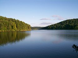
This two-lane spur route was established to improve access to the Clendening Lake region.
[4] This state highway exists entirely within the western part of Harrison County.
From this point, passing first amidst some open fields before entering into a more forested terrain, with the occasional house appearing along the way, SR 799 roughly parallels the Clendening Lake shoreline about one-quarter mile (0.40 km) to the south, in the process entering Nottingham Township, dipping briefly into Moorefield Township before turning north, re-entering Nottingham Township, and then following Clendening Lake's eastern edge.
The highway has been a spur route since its inception, following the same alignment through the Clendening Lake vicinity from that point to this very day.