Okinawa Island
It is roughly 640 kilometres (350 nmi; 400 mi) south of the main island of Kyushu and the rest of Japan.
The island was formally controlled by the United States Civil Administration of the Ryukyu Islands until 1972, with around 26,000 U.S. military personnel stationed on Okinawa today, comprising about half of the total complement of the United States Forces Japan, spread among 31 areas, across 13 bases and 48 training sites.
[8][9] After the late Shell Mound period, agriculture started about the 12th century, and the population center moved from the seashore to higher places.
Many gusuku and related cultural remains in the Ryukyu Islands have been listed by UNESCO as World Heritage Sites.
There are three perspectives regarding the nature of gusuku: that they were holy places, dwellings encircled by stones, and castles of the rulers.
[10] King Satto, leading Chūzan, was very successful, establishing relations with Korea and Southeast Asia as well as China.
His son Shō Shin conquered the Sakishima Islands and centralized the royal government, the military, and the noro priestesses.
In 1609, the Japanese Satsuma Domain launched the invasion of Ryukyu, ultimately capturing the king and his capital after a long struggle.
The monarchy in Shuri was abolished, and the deposed King Shō Tai was forced to relocate to Tokyo.
In 1965, Admiral Ulysses S. Grant Sharp stated that "Without Okinawa, we couldn't continue fighting the Vietnam war.
[16] The 1970s and 1980s also had severe pollution of waterways and wells with PFAS: toxic chemicals in foam used by fire fighting training at U.S. facilities such as Kadena Air Base.
[35]: 131–132 Possible explanations are diet, low-stress lifestyle, caring community, activity, and spirituality of the inhabitants of the island.
[35][page needed] The Okinawan diet consists of low-fat, low-salt foods, such as whole fruits and vegetables, legumes, tofu, and seaweed.
Similarly, from the Motobu Peninsula on the northwestern side, all of Sesoko-jima plus Yagaji Island and Kōri-jima are connected by bridges.
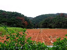
The southern end of the island consists of uplifted coral reef, whereas the northern half has proportionally more igneous rock.
The Indian mongoose was introduced to the island to prevent the native habu pit viper from attacking the birds.
[42] In 2021, coconut crabs were found to live in a small cave system on the islet Nagashima off the Henoko district.
Among the prefectures of Japan, Okinawa has the youngest and fastest-growing population but has the lowest employment rate and average income.
The island economy is primarily driven by tourism and the U.S. military presence, with efforts in recent years to diversify into other sectors.
[48] The Motobu Peninsula has a large-scale quarry and cement factory, taking advantage of the limestone in the area.
In 2013, there were approximately 50,000 U.S. military personnel stationed in Japan with 40,000 dependents and 5,500 American civilians employed by the United States Department of Defense.
[59][60][61] In 1997, the peculiar inhabitant population of this island [both Americans and Japanese living together since 1945] was used to prove a curious conjecture.
This virus is isolated from urine, and another conjecture is that most children are infected from parents, and that too, through living at close quarters for years together.
Since it is assumed now that JCV subtypes are virtually unique to each world area, it is now used to determine human migration patterns.
[65][66] In 2012, an agreement was struck between the United States and Japan to reduce the number of U.S. military personnel on the island, moving 9,000 personnel to other locations and moving bases out of heavily populated Greater Naha, but 10,000 Marines will remain on the island, along with other U.S. military units.
[69] In late December 2013, Governor Hirokazu Nakaima gave permission for land reclamation to begin for a new U.S. military base at Henoko, reneging on previous promises and furthering the effort to consolidate the American troop presence on the island, though away from urban Naha.
[70] In December 2016 the U.S. returned 10,000 acres (40 km2; 16 sq mi) of the Northern Training Area on Okinawa to Japan.
[74] Naha Airport is the main transportation hub for the Ryukyu Islands and has an increasingly large role in regional logistics.
All Nippon Airways opened a cargo hub at the airport in 2009, providing overnight freight service between Japan and other Asian countries.
The Okinawa Expressway is a toll road that runs from Naha to Nago, and has a speed limit of 80 km/h (50 mph), the highest on the island.