Ontario Highway 6
The original designation, not numbered until 1925, connected Port Dover with Owen Sound via Hamilton and Guelph.
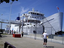
The Chi-Cheemaun ferry serves automobile traffic, connecting Tobermory with South Baymouth between May and October.
The road travels into Haldimand County, through communities such as Jarvis and Hagersville, and the traffic flow increases.
As this narrow segment suffers from significant congestion, a bypass is being considered which will connect to the Hanlon Expressway at Highway 401.
The Ministry of Transportation is presently investigating the possibility of upgrading it to 400-series freeway standards by removing the remaining intersections.
Following Woodlawn, Highway 6 then turns north onto Woolwich Street, leaving the city of Guelph.
[4][5] As Highway 6 leaves Guelph and heads northwards through Wellington County, it narrows to two lanes and passes through farmland.
After exiting Arthur, the route continues northwest for 22 kilometres (14 mi) before entering Mount Forest and meeting an intersection with Highway 89.
[4][5] At Tobermory, the highway travels along Carlton Road and Front Street, where motorists must queue for the Chi-Cheemaun ferry to continue onwards to Manitoulin Island.
[citation needed] The journey by ferry traverses waters of both Georgian Bay and Lake Huron, and takes approximately 1 hour and 45 minutes.
The section from South Baymouth to the Highway 542 junction has the least traffic on a given day, with an average of 610 vehicles passing as measured in 2010.
[8] After crossing the North Channel, Highway 6 climbs through the La Cloche Mountains near Whitefish Falls.
Eventually, it arrives in Baldwin, north of Espanola, ending at Highway 17 in the community of McKerrow, 117 kilometres (73 mi) from South Baymouth.
[9][10] In 1837, Charles Rankin was hired by the Canada Company to survey a line between Guelph and a new town site on the southern shore of Georgian Bay known as Sydenham.
[15] The wagon road, merely a trail through the forest, was cleared by the Canada Company in the 1820s to connect the fledgling town of Guelph with the established harbour at Hamilton, thus encouraging settlers to venture inland.
The Centre Road, the spine of the Bruce Peninsula, was built by the Department of Northern Development in the early 1920s, providing access to communities north of Wiarton.
The route followed a telegraph line between Lion's Head and Tobermory and opened up a large area previously accessible only by water.
[17] These roads were assumed from the various counties that held jurisdiction over them – Norfolk, Haldimand, Wentworth, Wellington and Grey – throughout June, July and August 1920.
[2] Within Wentworth County, the construction of the Clappison Cut through the Niagara Escarpment was underway by 1921, with the aim of bypassing the winding old route that is known today as Old Guelph Road.
The 19.0 kilometres (11.8 mi) road between Highway 8 and Highway 24, through Beverley and South Dumfries was designated on June 18, while the 6.8-kilometre (4.2 mi) section of the Governor's Road, along the boundary between South Dumfries and Brantford Township, was designated several months later on September 24.
Two weeks later, on August 25, Highway 6 was designated in Bruce County, from Wiarton north to Tobermory.
[32] The lone remaining section of what would eventually become today's Highway 6, across Manitoulin Island, was not designated until December 7, 1955.
[34] Under the leadership of Thomas B. McQuesten, who would soon introduce the freeway to Ontario, a new grand entrance to Hamilton was planned.
[35] It was subsequently bypassed, when the new Highway 6 opened to the southwest of John C. Munro Hamilton International Airport, on November 26, 2004.
[37] Hanlon Expressway With the rapid suburban expansion of Guelph in the 1950s and 1960s, a revised transportation plan was conceived to handle the increasing traffic load.
[45][47] Caledonia Bypass In 1976, a corridor study was completed on Highway 6 between Port Dover and Hamilton, indicating a need for a bypass of Caledonia due to the aging multi-span bridge over the Grand River, to improve capacity to the developing areas of Nanticoke near Lake Erie,[48] and to reduce the high-volume of truck traffic passing through the town.
[49] Construction began in late 1979 on structures to cross the Grand River and to carry rail lines and three crossroads over the bypass.
[1][52] A new 9.7-kilometre-long (6.0 mi) segment of Highway 6 was opened to the southwest of John C. Munro Hamilton International Airport in 2004.
[54] Construction of the $33 million route was announced on May 26, 2000 by Transportation Minister David Turnbull,[55] and began in July 2003.
The following table lists the major junctions along Highway 6, as noted by the Ministry of Transportation of Ontario.