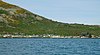
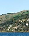
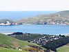
Otago Harbour
The last eruptive phase ended some ten million years ago, leaving the prominent peak of Mount Cargill.
Taiaroa Head, at the tip of the Otago Peninsula, is home to the only "mainland" colony of northern royal albatrosses in the world.
[citation needed] The bay and peninsula provides a critical habitat for Hooker's sea lions and New Zealand fur seals.
Southern right whales were historically seen inside the entrance of the harbour possibly up to Quarantine and Goat Island / Rakiriri.
[14] George Bass made the Dunedin end of the harbour the north east limit of his proposed fishing monopoly in 1803.
[16] William Tucker (1784–1817) was with a gang employed by Robert Campbell, a Sydney merchant, who were dropped on islands off the Dunedin coast in November 1809.
[18] A much-discussed affray in that conflict occurred after James Kelly of Hobart anchored the Sophia in the harbour in December 1817 with William Tucker on board.
After a visit to nearby Whareakeake (Murdering Beach), where Tucker had been living since 1815, and where he and two other men were killed, Kelly took revenge on Māori on his ship in the harbour, including local chief Korako.
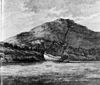
In 1826 Thomas Shepherd, one of a party of intending colonists, explored the site of Dunedin and left the oldest surviving pictures of the harbour and nearby coast, now in the Mitchell Library in Sydney.
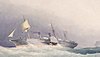
By that time whaling had collapsed and Dumont D'Urville and his officers, visiting in 1840, observed the port had become the centre of a riotous trade in liquor and prostitution.
While Otago Harbour might have the appearance of an excellent deep-water port, it was not naturally suited to such a role, especially in the early days of settlement when ships needed to dock close to the city.
[24] A significant area at the head of the harbour — much of it referred to as the Southern Endowment — has been reclaimed since the founding of Dunedin, primarily for industrial use.
The channel is maintained by Port Otago Ltd, which keeps it dredged to a depth of eight metres, allowing ships of up to 40,000 tonnes deadweight to travel up the harbour to Dunedin.
A channel along the western side of the harbour is regularly dredged, allowing vessels with a draught of 12.5 m to Port Chalmers, and 8 m all the way to the heart of Dunedin.
A long-distance cycleway and walkway, Te Aka Ōtākou, runs parallel to both roads along the harbour's edge for 36 kilometres (22 mi).
The South Island Main Trunk railway also runs parallel to the state highway on the western side of the harbour.