Ozarks
[4][5][6] Another possible etymological origin might be the French phrase aux arcs, meaning "[land] of the arches",[7] in reference to the dozens of natural bridges formed by erosion and collapsed caves in the Ozark region.
Kept open by periodic fires that limit growth of grasses and forbs in shallow soil, glades are home to collared lizards, tarantulas, scorpions, cacti and other species more typical of the Desert Southwest.
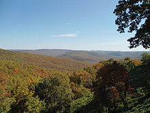
Many Ozark waterways have their headwaters in the uplands of the Boston formation, including the Buffalo, Kings, Mulberry, Little Red and White rivers.
[24] The St. Francois Mountains in the northeastern Ozarks are the eroded remnants of an ancient range which form the geological core of the highland dome.
These flanking reefs were points of concentration for later ore-bearing fluids which formed the rich lead-zinc ores that have been and continue to be mined in the area.
[26] A major unconformity in the region attests that the Ozarks were above sea level for several hundred million years from the time of the volcanism in the Precambrian until the mid-Cambrian with an erosionally produced relief of up to 1,500 feet (460 m).
This carbonate formation, the Bonneterre, now mostly dolomite, is exposed around the St. Francis Mountains, but extends in the subsurface throughout the Ozarks and reaches a thickness of 400 to 1,500 feet (120 to 460 m).
[26] The Ozark region remained as a subsiding shallow carbonate shelf environment with a significant thickness of cherty dolomites such as the Jefferson City, Cotter and Powell formations.
Formal conservation in the region began when the Ozark National Forest was created by proclamation of President Theodore Roosevelt in 1908 to preserve 917,944 acres (3,714.79 km2) across five Arkansas counties.
Commercial farms and processing operations are known to raise levels of chemical and biological contaminants in Ozark streams, threatening water supplies, recreational use and endangered native species.
Most of the dams in the region were initially built for the dual purpose of flood control and hydropower generation but have also become major economic drivers through recreational use in places such as Branson, Missouri, and Mountain Home, Arkansas.
[40] Many cemeteries, farm roads, river fords and railways were lost when the lakes came, disrupting rural culture, travel and commerce.
The designation came after over a decade of battling a proposed Army Corps dam in the media, legislature, and courts to keep the Buffalo River free flowing.
Forming the west central border of the Ozarks from Missouri through Kansas and into Oklahoma are the Spring River and its tributary, Center Creek.
Grand Falls, Missouri's largest natural waterfall, a chert outcropping, includes bluffs and glades on Shoal Creek south of Joplin.
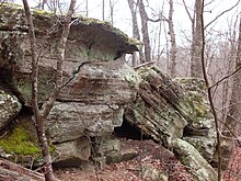
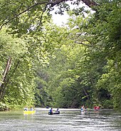
Ozark rivers and streams are typically clear water, with baseflows sustained by many seeps and springs, and flow through forests along limestone and dolomite bluffs.
Historically, the lead belt around the Saint Francois Mountains and the Tri-State district lead-zinc mining area around Joplin, Missouri, have been important sources of metals.
Logging of both softwood and hardwood timber species on both private land and in the National Forests has long been an important economic activity.
However, deforestation of frontier forest contributed through erosion to increased gravel bars along Ozark waterways in logged areas; stream channels have become wider and shallower, and deepwater fish habitat has been lost.
Logging and timber industries are also significant in the Ozark economy, with operations ranging from small family-run sawmills to large commercial concerns.
[69] Winter's Bone,[70] a novel by Daniel Woodrell (author of Woe to Live On), reflects on contemporary methamphetamine culture and its impact on families on the plateau.
Several early and influential country-music television and radio programs originated from Springfield in the 1950s and '60s, including ABC-TV's Ozark Jubilee and The Slim Wilson Show on KYTV.
[72] Examples of commercial interpretations of traditional Ozark culture include the two major family theme parks in the region, Silver Dollar City and the now defunct Dogpatch USA, and the resort entertainment complex in Branson.
Traditional Ozark culture includes stories and tunes passed orally between generations through community music parties and other informal gatherings.
Moreover, historian Vance Randolph attributes the formation of much Ozark lore to individual families when "backwoods parents begin by telling outrageous whoppers to their children and end by half believing the wildest of these tales themselves.
[63] Evidenced by Randolph's extensive field work, many Ozark anecdotes from the oral tradition are often bawdy, full of wild embellishments on everyday themes.
[75][76] In 1941–42, commissioned by Alan Lomax of the Archive of Folk Culture, Randolph returned to the Ozarks with a portable recording machine from the Library of Congress and captured over 800 songs, ballads and instrumentals.
[71][78][79][80] In 2007, Gordon McCann, a chronicler of Ozarks folklife and fiddle music for over four decades, donated a collection of audio recordings, fieldnotes and photographs to Missouri State University in Springfield.
From 1973 to 1983, the Bittersweet project, which began as an English class at Lebanon High School in Missouri, collected 476 taped and transcribed interviews, published 482 stories, and took over 50,000 photographs documenting traditional Ozark culture.
[82] Population influx since the 1950s,[37][39] coupled with geographically lying in both the Midwest and Upper South, proximity to the Mississippi embayment, the Osage and Northern Plains, contributes to changing cultural values in the Ozarks.