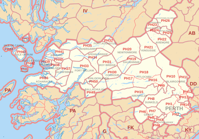
PH postcode area
The PH postcode area, also known as the Perth postcode area,[2] is a group of 43 postcode districts for post towns: Aberfeldy, Acharacle, Arisaig, Auchterarder, Aviemore, Ballachulish, Blairgowrie, Boat of Garten, Carrbridge, Corrour, Crieff, Dalwhinnie, Dunkeld, Fort Augustus, Fort William, Glenfinnan, Grantown-on-Spey, Invergarry, Isle of Canna, Isle of Eigg, Isle of Rum, Kingussie, Kinlochleven, Lochailort, Mallaig, Nethy Bridge, Newtonmore, Perth, Pitlochry, Roy Bridge and Spean Bridge in Scotland.
The main post town of Perth and its surrounding villages are covered in PH1 (north and west) and PH2 (east and south).
PH11 to PH14 cover lower-lying Strathmore and Carse of Gowrie to the north-east and east.
PH30 to PH36 cover landward areas around Fort William and the Great Glen, to the west, north and east.
PH37 to PH41 cover the remote west coast (including the most western point of the Scottish mainland) to Mallaig.