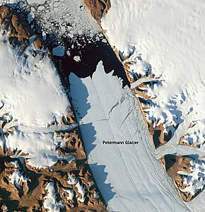
Petermann Glacier
The distance of this rifts or cracks back from the terminus has diminished for this time period also and may serve as a precursor to natural ice calving from Petermann Glacier.
The Danish Meteorological Institutes maintains an archive of imagery of Petermann Glacier and adjacent coastal areas of Greenland[8][9] from both European and US satellites and sensors such as Envisat, MODIS, and AVHRR.
Data from Operation IceBridge show a 750 km long subglacial canyon running from the center of the island northward to the fjord of the Petermann Glacier.
[10] The US Coast Guard icebreaker "USCGC Healy" entered the fjord on August 11, 2003 to survey bottom topography, ocean currents, and ocean chemistry as part of a larger program funded by the US National Science Foundation to better understand rates and mechanism by which Arctic sources of fresh water may impact the climate states of the North Atlantic.
The purpose of the Swedish-American research expedition was to collect multibeam bathymetry and sub-bottom profile information along the western continental shelf of Greenland in order to characterize the shape of the seafloor and uppermost sediment properties.
The main goal was to increase the understanding about potential pathways of relative warmer water influx towards Greenland's many outlet glaciers.
In August 2010, a giant iceberg measuring 260 square kilometres (100 sq mi) broke off from the floating portion of Petermann Glacier reducing its area and volume by about 25% and 10%, respectively.
[11] The Select Committee on Energy Independence and Global Warming of the US House of Representatives held hearings on Petermann Glacier and the Greenland icesheet within days of the 2010 break-up.