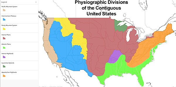
Physiographic regions of the United States
The physiographic regions of the contiguous United States comprise 8 divisions, 25 provinces, and 85 sections.
[1] The system dates to Nevin Fenneman's report Physiographic Divisions of the United States, published in 1916.
The use of province in this hierarchy undoubtedly confounded the effort to develop a physiographical map consistent across the North American continent since Canada used province as the term for its first-level political subdivision.
Province in Canada is a loose analogy for state in the US, and obviously would create great confusion if the same word was used in two vastly different geographical classifications.
As late as 1914, the terminology used by an AAG publication used the term "natural region" as the basic denomination of physiography.