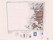
Wilkniss Mountains
They are separated from Knobhead by the Ferrar Glacier, which flows east from its head near Mount Blackwelder.
[6] This stability of ice surface elevation suggests that over the last 4 million years the upland regions of the McMurdo Dry Valleys have experienced minimal climatic amelioration.
An ice-free valley on the east side of Mount Blackwelder in the northeast part of Wilkniss Mountains, Victoria Land.
The name is one of a group in the area associated with surveying applied in 1993 by NZGB; vernier being a graduated scale used on measuring instruments to allow the reading of finer subdivisions.
Glacier, 4 nautical miles (7.4 km; 4.6 mi) long, flowing northeast from Creagh Icefall to the vicinity of Canoe Nunatak.
Named by US-ACAN in 1994 after Father Gerry Creagh (d. 1994), a New Zealand citizen, who served as honorary United States Navy chaplain for over 25 summer seasons at the Chapel of the Snows, McMurdo Station.
So named by New Zealand Geographic Board (NZGB) (1994) because a buttress spur on the east side of the nunatak leads to the summit.
Prominent conical peak, 2,470 metres (8,100 ft) high, distinguished by a large northeast cirque and as the highest point in Wilkniss Mountains.
A distinctive ice-free valley which descends northeastward from the Pivot Peak cirque, in Wilkniss Mountains, Victoria Land.
[16] This article incorporates public domain material from websites or documents of the United States Geological Survey.