Plotlands (land development)
Plotlands were areas of cheap British farmland, including along the coast and rivers, which, between the 1890s and 1939, were divided and sold for holiday homes or as smallholdings.
[1] Described as "a makeshift world of shacks and shanties, scattered unevenly in plots of varying size and shape, with unmade roads and little in the way of services"[2] plotland developments gave the economically disadvantaged the opportunity to "take their own place in the sun".
[5] Immediately after WWI there was a "dire shortage" of housing, so people used obsolete army huts, converted buses, caravans, railway carriages,[6] coal barges,[7] and kit-built wooden chalets[8] to create "temporary shanties", taking advantage of the "depressed prices of agricultural land and the absence of planning controls.
"[10] Until at least 1939, most plotlands developed without services: no mains electricity, street lighting, water, sewage or tarmacked roads.
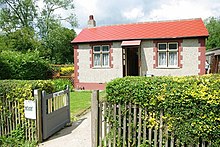
[12] Plotland locations included: Callow Green, Canvey Island, Hardwick Wood, Humberston Fitties, Isle of Sheppey, Jaywick Sands, Central Park, Peacehaven, Pitsea, Point Clear, Ram Hill, Rochester Park and Garden Suburb, Rye Bay, Selsey Peninsula, Saltdean, Shotgate, Vange Hill and Woodingdean.