Port Burwell, Ontario
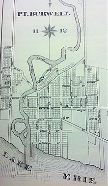
Port Burwell is a community on the north shore of Lake Erie, in the Municipality of Bayham in Elgin County, Ontario, Canada.
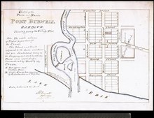
[1][2] It is situated at the mouth of Big Otter Creek, which stretches more than forty miles north through Bayham to Tillsonburg and Otterville, and the harbour at Port Burwell was of historic importance in the development of landlocked Oxford County.
In 1810, besides finishing a government contract for the survey of a large part of what became known as the Talbot Road in response to petitions from land grant recipient Colonel Thomas Talbot, Mahlon Burwell (1783–1846) received instructions to survey the vacant land between Houghton and Yarmouth townships, and to divide it into two townships, under the names of Malahide and Bayham.
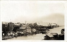
[7] In time Port Burwell became a shipbuilding and fishery harbour and the export point for lumber and farm produce from the surrounding townships and a large portion of Oxford County, boosted by construction of roads and railway lines.
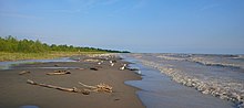
By the 1920s Port Burwell was becoming a summertime tourist destination famous for its sandy beaches, which had formed over the years as a natural result of wind and water currents interacting with the breakwaters extending out from the harbour mouth.
[12] It also gained fame as the home of McConnell Nurseries, which relied upon the sandy loam in nearby farmland and the reduced frost risk near the lakefront.
Locations and histories of churches and cemeteries have been studied and documented extensively by the Elgin County branch of the Ontario Genealogical Society:[34]