Porter County, Indiana
Porter County is the site of much of the Indiana Dunes, an area of ecological significance.
[7][8][9] The Hour Glass Museum in Ogden Dunes documents the region's ecological significance.
[10] The Porter County area was occupied by an Algonquian people dubbed Huber-Berrien.
The trading post system used by the French and then the English encouraged native people to live in central villages along major waterways.
[11] Chiqua's town is a mile east of Valparaiso on State Route 2, the old Sauk Trail.
President Thomas Jefferson chose William Henry Harrison as the governor of the territory, and Vincennes was established as the capital.
The construction of the mill, as well as the neighboring Port of Indiana, generated enormous controversy between industrial interests and locals who wanted to conserve the natural shoreline and habitat.
Although the activists lost and the steel mill and port were constructed, the US Congress created the Indiana Dunes National Lakeshore in 1966 to protect the area's unique natural habitat.
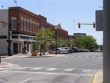
[18] Porter County lies on the northern edge of Indiana; its north border is formed by Lake Michigan and its south border is formed by the westward-flowing Kankakee River Its once-tree-covered low rolling hills have been cleared and devoted to agriculture; the only exceptions in Porter County are the drainages carved into the terrain, which are brush-filled.
The East Arm Little Calumet River flows westward through the upper portion of Porter County.
[19] The highest point, at 870 feet (270 m),[20] is a small hill on the county's east border, 2.75 miles (4.4 km) NW of Westville.
The commissioners execute acts legislated by the council, collect revenue and manage the county government.
The judge on the court is elected to a term of four years and must be a member of the Indiana Bar Association.
It has become a swing county in recent years, voting for the national winner in every presidential election since 1980 except for 1992 and 2020.