BT postcode area
BT borders nine Eircode routing areas in the neighbouring Republic of Ireland: F94, F93, F91, N41, H23, H18, H14, A91, and A75.
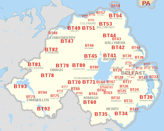
[3] Today, the Belfast post town covers postcode districts BT1 to BT17 and part of BT29.
In common with all addresses in Northern Ireland, Belfast postcodes start with the letters BT, a mnemonic of the capital city's name.
The remainder of Northern Ireland is divided into 43 other post towns which are further divided into postcode districts BT18–BT49, BT51–BT57, BT58 (non-geographic postcode district reassigned from Belfast to Newtownabbey post town), BT60–BT71, BT74–BT82 and BT92–BT94.
Certain addresses in BT29 located at Belfast International Airport (a total of 31 delivery points) are in the post town of BELFAST despite being geographically under the post town of CRUMLIN, which has the remaining 7,206 delivery points in that postcode area.