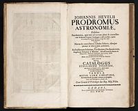
Prodromus Astronomiae
It provides examples of the use of the sextant and quadrant by Hevelius, in tandem with known positions of the sun, in calculating each stars' longitude and latitude.
Although the observations of the catalog used nothing more than the astronomer's naked eye, the measurements were so precise as to be used in the making of celestial globes into the early 18th century.
[1] Firmamentum Sobiescianum, while technically part of the Prodromus Astronomiae, was likely published separately and in tighter circulation.
Housing its own cover page and page-numbering system, the atlas consisted of two hemispheres and 54 double-page plates of 73 constellations.
Both the northern and southern hemispheres were centered on an ecliptic pole, and most star locations were all based on Hevelius' own observations.