Renville County, Minnesota
It was named for Joseph Renville, a fur trapper, trader, British officer in the War of 1812, and interlocutor with local Native American groups.
[3] Renville County, located directly across the Minnesota River from the Lower Sioux Agency, was the site of extensive combat during the Dakota War of 1862.
The burned-out Joseph Brown House Ruins still stand, and various monuments throughout the County memorialize settlers killed in the conflict.
Hawk Creek flows south through the county's western end, discharging into the Minnesota.
Beaver Creek drains the central part of the county, flowing southeast before turning southwest to discharge into the Minnesota.
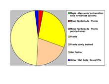
The county terrain consists of rolling hills etched by drainages and sprinkled with lakes and ponds.
[5] The county terrain slopes to the south, with its highest point near the midpoint of the northern border, at 1,122 ft (342 m) ASL.