Rhode Island Route 37
This extended route was approved and given the I-895 designation in 1968, but the extension was ultimately canceled by the Rhode Island Department of Transportation (RIDOT).
In the 1980s, Route 37 was included in proposals for an eastward extension of Interstate 84 from Hartford, Connecticut, to Rhode Island, but this alignment was also canceled.
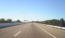
[1] Shortly after the intersection with Natick Avenue, Route 37 begins to head in a northeastern direction and has its first numbered exit at a cloverleaf interchange with I-295.
[citation needed]Shortly after Exit 1E, Route 37 crosses over the Pawtuxet River and enters the city of Warwick.
The freeway crosses Jefferson Boulevard and Amtrak's Northeast Corridor railroad on twin-span bridges and passes to the north of the Lincoln Park Cemetery before interchanging with US 1 at exits 3A-B.
The plan, which was approved by both RIDPW and the Massachusetts Highway Department (MassHighway), involved extending Route 37 eastward from its existing terminus at US 1 across Narragansett Bay via a new bridge that would connect Warwick with the town of Barrington.
[6] In 1971, however, the expressway's original routing was canceled due to community opposition in the towns of Barrington and Warren and concerns that a new bridge across Upper Narragansett Bay would interfere with aviation traffic at T. F. Green Airport.
The expressway was included in a proposal to extend I-84 eastward from Hartford, Connecticut, to Providence; more northern alignments for the freeway had been rejected due to concerns of potential damage to the Scituate Reservoir.
The department conducted planning studies on two proposed freeway alignments that would extend Route 37 into Downtown Warwick.
[10] The first option was ultimately dropped by RIDOT after studies indicated the routing would interfere with aviation traffic at T. F. Green Airport.
[13] In June 2006, erosion resulting from heavy rains exposed human remains near the westbound lanes of Route 37 in Cranston.
Subsequent drainage improvements to the freeway led to the discovery of human remains from more than 70 individuals buried in late 19th and early 20th centuries.