River Don, Yorkshire
It rises in the Pennines, west of Dunford Bridge, and flows for 69 miles (111 km) eastwards, through the Don Valley, via Penistone, Sheffield, Rotherham, Mexborough, Conisbrough, Doncaster and Stainforth.
Below Doncaster, the main channel of the lower Don originally meandered in a north-easterly direction across the marshland of Hatfield Chase to enter the Trent just above its junction with the Ouse.
In the Hatfield Level drainage project which started in 1626, the Dutch civil engineer Cornelius Vermuyden diverted the Don northwards along Turnbridgedike.
[3] The Dutch River was difficult to navigate, made more hazardous by shoals, three awkward bridges, and low water levels at neap tides.
[13] The river burst its banks in the late afternoon, flooding areas of Sheffield from Hillsborough to Meadowhall, and two people died after being swept away by the water.
[14] Two days later, the army were called in to assist at Barnby Dun after the river flooded large areas near Thorpe Marsh Power Station.
Despite the steady improvement in water quality, restocking of the river with fish, attempted on several occasions between 1981 and 1994, was largely ineffective, caused by intermittent discharges of pollutants.
Like most rivers in the UK, the chemical status changed from good to fail in 2019, due to the presence of polybrominated diphenyl ethers (PBDE), perfluorooctane sulphonate (PFOS) and mercury compounds, none of which had previously been included in the assessment.
A series of small streams, including Great Grains and Black Grough join up, and within 1.2 miles (1.9 km) enter Winscar Reservoir.
[39] The Don flows from the foot of Winscar Dam, close to the eastern portal of the Woodhead Tunnel, through the Hamlet of Dunford Bridge, and continues, first east and then south-east, on its way to Sheffield.
In February 2016 the Environment Agency removed the middle two-thirds of Beeley Wood Lower Weir as part of a scheme to allow the free migration of fish and let the river return to a more natural form.
In 1807 a lease was issued to a group of 32 tenants, which included a miller, grinders, cutlers, a button maker, a scissorsmith and an ivory turner.
[51] Sanderson's weir provided water for the Upper Hammer, on the south side of the river, which was converted into the Attercliffe slitting mill in 1746.
[62] Like most of the upper Don, the river at Oughtibridge appears fairly benign, with it having a small flow and being easily fordable below the weir to the south of the bridge.
It was originally erected to allow workmen across the river to work in the ganister mines of Beeley Wood and the factories in the Clay Wheels Lane area of Sheffield.
The footpath will eventually form part of the Upper Don Walk[65] The Cadbury's, previously Bassett's, works is one of the major employers in the area.
The firm was established in Sheffield in 1842 but did not come to Owlerton until 1934 when Bassett's son-in-law, Samuel Meggit Johnson, built a large factory on Beulah Road on the south side of the Don.
On 11 March 1864, the previous wooden bridge was swept away by the Great Sheffield Flood, caused by the collapse of Dale Dike Dam.
Alterations made in 1912 included rounded approaches, and lighting was provided by cast-iron gas lamps, contributed by the Neepsend Gasworks, which was located nearby.
In 1795 it was replaced by one of the earliest iron bridges, made by Samual Walker, an ironmaster from Rotherham and was depicted by an unknown artist, circa 1840.
It was built as part of a £65 million scheme to divert traffic away from the city centre, which included 0.94 miles (1.5 km) of dual carriageway running from Penistone Road to the Wicker.
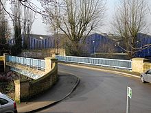
[80] This footbridge connects the re-development of the former Exchange Brewery site on the west side of the River Don with Nursery Street on the east.
The Wicker Arches are a 660-yard (600 m) railway viaduct, designed by the architects Weightman, Hadfield and Goldie to a specification by the engineer Sir John Fowler in 1848.
They were built by Miller, Blackie and Shortedge, and carried the Great Central Railway to Manchester across the canal, roads and the River Don at The Wicker.
The arch that takes the railway over the Don has stone abutments and a lattice girder span which was made in the late 19th century.
Designed by Sheffield City Council's Structures Section, the entire 330-foot-long (100 m) bridge is suspended on a web of steel cables secured to the underside of the viaduct, and it is this feature which gives it its name.
The bridge was placed here on 15 October 2006, was constructed in 1945, was built probably for the D-Day landings and was chosen deliberately to celebrate the world-beating engineering design.
The unique features of the invention were that a bridge capable of carrying tanks could be erected in a matter of hours from standard lightweight modules with little more than human muscle power and hand tools.
It was opened in 1900, was integrated into the LNER in 1923 and, in British Rail days, it connected Tinsley Marshalling Yard with the Midland Main Line at Brightside Junction.
Erected by Newton Chambers & Co Ltd, Thorncliffe Ironworks,[95] the bridge originally provided access to one of the works (Dunford Hadfields, Shardlows or Arthur Lees) that used to occupy the shopping centre site.