U.S. Route 66
[3] The highway, which became one of the most famous roadways in the United States, ran from Chicago, Illinois, through Missouri, Kansas, Oklahoma, Texas, New Mexico, and Arizona before terminating in Santa Monica in Los Angeles County, California, covering a total of 2,448 miles (3,940 km).
In 1857, Lt. Edward Fitzgerald Beale, a naval officer in the service of the U.S. Army Corps of Topographical Engineers, was ordered by the War Department to build a government-funded wagon road along the 35th Parallel.
[12] From the outset, public road planners intended US 66 to connect the main streets of rural and urban communities along its course for the most practical of reasons: Most small towns had no prior access to a major national thoroughfare.
A controversy erupted over the number 60, largely from delegates from Kentucky who wanted a Virginia Beach–Los Angeles highway to be US 60 and US 62 between Chicago and Springfield, Missouri.
The race ended in Madison Square Garden, where the $25,000 first prize (equal to $443,605 in 2023) was awarded to Andy Hartley Payne, a Cherokee runner from Oklahoma.
The Dust Bowl of the 1930s saw many farming families, mainly from Oklahoma, Arkansas, Kansas, and Texas, heading west for agricultural jobs in California.
One section through the Black Mountains outside Oatman, Arizona, was fraught with hairpin turns and was the steepest along the entire route, so much so that some early travellers, too frightened at the prospect of driving such a potentially dangerous road, hired locals to navigate the winding grade.
[22] Notable buildings include the art deco–styled U-Drop Inn, constructed in 1936 in Shamrock, in Wheeler County east of Amarillo, Texas, listed on the National Register of Historic Places.
When Richard Feynman was working on the Manhattan Project at Los Alamos, he used to travel nearly 100 miles (160 km) to visit his wife, who was dying of tuberculosis, in a sanatorium located on US 66 in Albuquerque.
This sharp increase in tourism in turn gave rise to a burgeoning trade in all manner of roadside attractions, including teepee-shaped motels, frozen custard stands, Indian curio shops, and reptile farms.
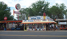
It also marked the birth of the fast-food industry: Red's Giant Hamburg in Springfield, Missouri, site of the first drive-through restaurant, and the first McDonald's in San Bernardino, California.
The sweeping curve on the southeast side of the city originally was intended to easily handle traffic at speeds up to 100 miles per hour (160 km/h), as part of an effort to make US 66 an Autobahn equivalent for military transport.
The same scenario was used in western Oklahoma, when US 66 was initially upgraded to a four-lane highway such as from Sayre to Erick to the Texas border at Texola in 1957 and 1958 where the old paving was retained for westbound traffic and a new parallel lane built for eastbound traffic (much of this section was entirely bypassed by I-40 in 1975), and on two other sections; from Canute to Elk City in 1959 and Hydro to Weatherford in 1960, both of which were upgraded with the construction of a new westbound lane in 1966 to bring the highway up to full interstate standards and demoting the old US 66 paving to frontage road status.
In the initial process of constructing I-40 across western Oklahoma, the state also included projects to upgrade the through routes in El Reno, Weatherford, Clinton, Canute, Elk City, Sayre, Erick, and Texola to four-lane highways not only to provide seamless transitions from the rural sections of I-40 from both ends of town but also to provide easy access to those cities in later years after the I-40 bypasses were completed.
In 1964, Tucumcari and San Jon became the first cities in New Mexico to work out an agreement with state and federal officials in determining the locations of their I-40 bypasses as close to their business areas as possible in order to permit easy access for highway travelers to their localities.
Several businesses were well known to be on US 66, and fear of losing the number resulted in the state of Missouri officially requesting the designation "Interstate 66" for the St. Louis to Oklahoma City section of the route, but it was denied.
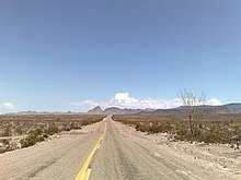
Although it is no longer possible to drive US 66 uninterrupted all the way from Chicago to Los Angeles, much of the original route and alternate alignments are still drivable with careful planning.
A surface street stretch between San Bernardino and La Verne (known as Foothill Boulevard) to the east of Los Angeles retains its number as SR 66.
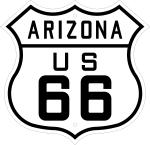
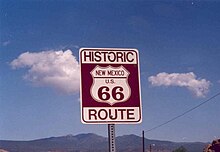
[22] In many communities, local groups have painted or stenciled the "66" and U.S. Route shield or outline directly onto the road surface, along with the state's name.
Until 2017, when it was moved to the nearby Millennium Park, the annual June Chicago Blues Festival was held each year in Grant Park and included a "Route 66 Roadhouse" stage on Columbus Avenue, a few yards north of old US 66/Jackson Boulevard (both closed to traffic for the festival), and a block west of the route's former eastern terminus at US 41 Lake Shore Drive.
[38][39] Since 2001, Springfield, Illinois has annually held its "International Route 66 Mother Road Festival" in its downtown district surrounding the Old State Capitol.
[43] The National Park Service developed a Route 66 Discover Our Shared Heritage Travel Itinerary describing over one hundred individual historic sites.
[53] In 2020, Avery Plaza Southwest opened, at the west end of the bridge, which features a "neon park" with replicas of the neon signs from Tulsa-area Route 66 motels of the era, including the Tulsa Auto Court, the Oil Capital Motel, and the famous bucking-bronco sign of the Will Rogers Motor Court.
is the Route 66 Historical Village, which includes a tourism information center modeled after a 1920s-1930s gas station, and other period-appropriate artifacts such as the Frisco 4500 steam locomotive with train cars.
[citation needed] In the John Steinbeck novel The Grapes of Wrath, the highway is called "The Mother Road", its prevailing title today.
[64] The terminus was located at the Pacific Coast Highway, then US 101 Alternate and now SR 1, at Lincoln and Olympic Boulevards in Santa Monica, California.
After passing through the suburbs, U.S. 66 entered Chicago itself, where it terminated at Lake Shore Drive[76] starting in 1938, having originally ended at Michigan Avenue.
The highway lent its name to the Route 66 TV series in the 1960s,[77] which itself had a popular theme song written and arranged by Nelson Riddle.
The novel The Grapes of Wrath, adapted to film in 1940, depicts the Joad family traveling to California on US 66 after being evicted from their small farm in Oklahoma.
[79]The 2006 animated film Cars had the working title Route 66, and described the decline of the fictional Radiator Springs, nearly a ghost town once its mother road, US 66, was bypassed by Interstate 40.