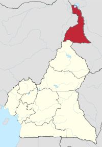
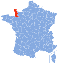
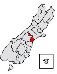
While similar to a peninsula in shape, a salient is most often not surrounded by water on three sides.
Instead, it has a land border on at least two sides and extends from the larger geographical body of the administrative unit.
In American English, the term panhandle is often used to describe a relatively long and narrow salient, such as the westernmost extensions of Florida and Oklahoma, or the northernmost portion of Idaho.
The term "panhandle" derives from the analogous part of a cooking pan, and its use is generally confined to North America.
The salient shape can be the result of arbitrarily drawn international or subnational boundaries, though the location of administrative borders can also take into account other considerations such as economic ties or topography.
Map of Namibia showing the
Caprivi Strip
in the country's northeast.
Map of India showing the Seven Sister states in the northeast plus the smaller salient of Sikkim immediately to their west.
The 14 provinces of Thailand forming the salient of Southern Thailand.
Dutch Limburg shown within the Netherlands
Misiones Province within Argentina
Location of Niari Department within the Republic of the Congo. The southeastern arm is the Kimongo District.
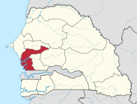
Location of the Fatick Region within Senegal. Gossas Department is the northeastern arm.
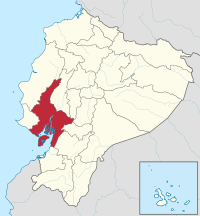
Guayas Province, Ecuador. Balzar and El Empalme Cantons form the northern arm of the province.
Venezuela's Barinas State. Andrés Eloy Blanco is the small western extension of the state, Arismendi is the larger eastern extremity. Páez, in Apure, lies immediately to the south of western Barinas.
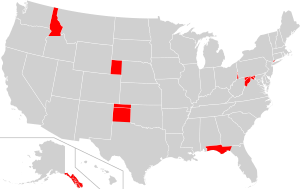
Locations of panhandles within states of the USA
Location of Nabatieh District within Nabatieh Governorate, Lebanon.
Map of Gorno-Badakhshan within Tajikistan, showing the panhandle of Darvoz District in the west.
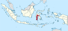
South Sulawesi in Indonesia, with a panhandle of East Luwu Regency in the east