Obersee (Zürichsee)
Zürichsee is the common name for the lower (Untersee) northwestern section of 68.2 square kilometres (26.3 sq mi), while the smaller southeastern upper (Obersee) lake area measures 20.8 square kilometres (8.0 sq mi), separated by the Seedamm causeway, a Molasse formation connecting Rapperswil with the Hurden peninsula.
Although every spring a circulation of the water occurs, often a visible lack of oxygen in July below a depth of 30 metres (98 ft) is observable, which lasts for several months.
The lake shore in the Canton of St. Gallen was divided into 50 portions of approximately 500 metres (1,640 ft) in length and described by 12 different parameters.
Instead of nutrients there is a high a load with floating mineral particles which prevents colonization of the sea floor in greater depths.
A comparison of aerial photographs from 1954 and 1987 shows in most shore sections of the machining area a significant decrease in the reed beds.
Geological rock outcrops, i.e. scenically striking rocky ridges are found in Fuchsberg and Stafflen in Jona, Heilig Hüsli in Rapperswil and the Hörnli glacial erratic in Oberbollingen.
The extensive area of shallow water with its diverse flora and the still widespread shore trees play an extremely important role for many bird species, both as food, breeding and resting place.
A critical phase in the evolution of birds is the time of moulting, during which they are more or less incapable of flying and depending on quiet water areas.
Due to the decline of the reed banks and the increase in interference from recovery operations and water sports on the lake shore, the number of breeding pairs is constantly decreasing.
[1] After the Seedamm causeway was built in 1878, the Heilig Hüsli chapel was the only remaining structure of the prehistorical and medieval lake crossings.
Landward there is reed vegetation with large and small sedge flora, rushes, Iris sibirica, and the rare Gentiana pneumonanthe.
In the nature reserve there are European rarities, among them Phengaris alcon, Eurasian curlew and Gentiana pneumonanthe, as well as Ruspolia nitidula, a small snail.
[3] Nuoler Ried is a reed located on the north end of a large plane that was filled by the Wägitaler Aa and Spreitenbach streams.
Larger areas of the present nature reserve, such as the so-called Schüttinsel, were created on the deposits of non-recyclable residual material from the nearby gravel extraction.
[5] On the southwestern side, between Grynau and Lachen there is namely the bird reserves of national importance Güntliweid up to Bätzimatt at Buechberg.
Depending on the layer, the appearance and texture of the natural stone also varies, therefore distinct names have developed at the different mining locations: Güntliweid, Buechberg and Uznaberg.
Since the incidence even partly is mined within the Güntliweid–Bätzimatt nature reserve, Bollinger sandstone usually is extracted with wire saws that cut the stone vertically in up to 60 metres (197 ft) deep shafts.
For example, the present Lehholz quarry dates back to 1252 AD when Rudolf II von Rapperswil founded the nearby Wurmsbach Abbey in Jona.
It was transferred with oxen to the lake shore transshipping point to be shipped with so-called Ledi boats towards the present Sechsläutenplatz Zurich far into the 19th century.
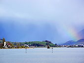
The pathway between Rapperswil and Schmerikon,[15] and the wooden bridge in the Seedamm area are very popular for hiking, as well as the 'fishing village' Hurden on its southern side is often frequented by tourists.
The private airfield Wangen-Lachen is located inmidst the protected area Nuoler Ried on the southern shore of the lake.
In 1949 a private pilot, a flight instructor and the aviation pioneer Alfred Comte entered into a lease agreement with the Genossame (cooperative) Wangen.
Since 1957 also seaplanes use the lake shore area, being today – the Ad Astra Aero airport at Zürichhorn was closed around 1931 – the last water airfield in Switzerland.
Accordingly, there is rush of boats from the lower lake area, i.e. west of the Seedamm isthmus, on nice summer days.
The environmentally sensitive Wurmsbach bay is a popular anchoring and bathing place, which represents a potential failure and thus a conflict with the high value of the shore habitats.
In much earlier era, Obersee and Tuggenersee also were separated by the Buechberg hill,[17] on those eastern side the Grynau Castle is situated.