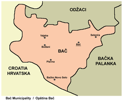
Selenča
[1] It is bounded by the village of Ratkovo on the north, Parage on the east, Tovariševo on the south, Deronje on the northwest and the town of Bač on the west and southwest.
The Bač Fishpond is located west of the village, while the protected reserve of the Karađorđevo hunting ground is just to the southwest.
Another wave of Slovak settlers from Slovakia, this time Roman Catholic ones, settled into the empty houses.
One, which claims that the toponym Selenča is a diminutive of the word selo, a generic Slavic term for a village in general.
[3][4] After World War II, Selenča municipality remained part of the srez Odžaci until they were abolished with the massive changes in the administrative and territorial changes in Yugoslavia in the late 1950s and early 1960s.
[2] In the 19th century, the Imperial Austrian surveyors were sent to re-measure the area and to set the future look of the village.
They measured and marked the main and side streets, divided the area in the lots for housing, yards, churches and other public buildings.
[1] Hence, Selenča is a typical settlement of the Pannonian type, compact, square shaped, with the regular grid-like layout of the streets.
However, as the village grew, generally in the southwest–northeast direction, the non-planned building and expansion produced irregular street patterns on the periphery.
Total area of the village is 32.13 km2 (12.41 sq mi)[2] By the 2000s, there were still surviving the old, original houses, made from the wattle daubed with mud, with wooden roofs covered with reed.
[2] Considered a prosperous settlement, by the 2000, Selenča had a kindergarten, a modern community health center, cultural center, founded in 1948, with large library and a cinema, Slovak cultural-artistic society "Jan Kolar", also founded in 1948, with drama, music and dance sections and a hunters association.