Shannopin's Town
In the early 1700s, British colonial settlers began spreading into western Pennsylvania, forcing Lenape and other American Indian tribes to move further west, settling in the Ohio Country.
[1] The town was largely abandoned during the construction of Fort Duquesne in 1754, although a small community still existed when General John Forbes' troops arrived in September 1758.
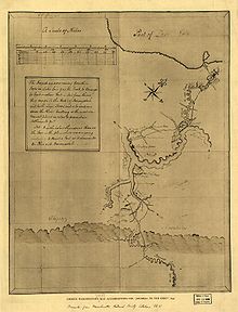
[2]: 121 [3]: 753 Modern attempts to pinpoint the exact location of Shannopin's Town are based on settler's journals, early maps, and a burial site which was uncovered during building excavations in 1862.
"[6][7]: 526 William West reported that, on 16 June 1752, Shannopin's Town was found to be at "Forty Degrees twenty-seven minutes North latitude,"[8]: 963 according to a measurement taken by Joshua Fry.
[9]: 761 On November 15, 1753, Lewis Montour informed the Governor and the Speaker of the Assembly that "Shanoppin Town" was situated about three miles above the Forks of the Monongahela.
Shannopin and the other signatories wanted to limit the free trade of rum and the numbers of people traveling from the European settlements in the east.
"[2][12]: 254–55 On 8 August 1732 Shannopin's name appears signed to a message sent by the Delawares on the Allegheny to Deputy Governor Gordon, promising to come to Philadelphia the following spring.
The letter states: On 29 October 1731, James Le Tort and his colleague Jonas Davenport were called to testify before Governor Patrick Gordon.
[3] Conrad Weiser spent the night of August 26, 1748 at Shannopin's Town on his way to Logstown for a meeting with chiefs of the Delaware, Shawnee, Iroquois and Wyandot nations.
The commissioners were Colonel Joshua Fry, James Patton, and Lunsford Lomax,[25] accompanied by Christopher Gist and Andrew Montour, who served as interpreter.
They spent the following day in conference with the chiefs, and noted that the Lenape had no king, but were represented by Shingas and his brother Tamaqua, both of whom, supplied with coats and hats by the commissioners, "were dressed after the English fashion."
They made favorable impressions with the commissioners, who informed the Lenape that they were to meet the Six Nations at Logstown to improve relationships between the King’s representatives and the Ohio Indians.
[31][9]: 702 In January, 1754 British soldiers under the command of William Trent began construction of Fort Prince George at the confluence of the Ohio and the Monongahela rivers, about two miles west of Shannopin's Town.
[32][33]: 129 In April, a force of more than 500 men under the command of Captain Claude-Pierre Pécaudy de Contrecœur sailed down the Allegheny River from Venango, landing at Shannopin's Town.
[36] Shannopin's Town was largely abandoned during the construction of Fort Duquesne, but a small community still existed when John Hogan, a British prisoner, observed it in August, 1756.
[31] Archaeological work in the Pittsburgh area sponsored by the Carnegie Museum of Natural History has uncovered relatively little from the 18th century, due to disturbance of sites by construction and industry.