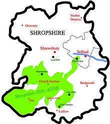
Shropshire Hills National Landscape
The A49 road and Welsh Marches Railway Line bisect the area north–south, passing through or near Shrewsbury, Church Stretton, Craven Arms and Ludlow.
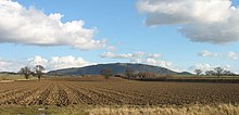
More accessible hills are the Long Mynd, which covers an area of 5,436 acres (22.0 km2) and peaks at Pole Bank at a height of 516 metres (1,693 feet), is near Church Stretton.
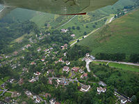
The Wrekin (407 metres (1,335 ft)), located in the far northeastern panhandle of the AONB, is an extremely popular hill with a well-used trail.
Located near Wellington, its position close to the major population centres of Shropshire, and good transport links (A5/M54) make it easy to access.
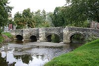
Attractions of historical interest located within or near the AONB include Stokesay Castle (near Craven Arms), a well-preserved fortified manor house.