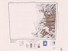
Quartermain Mountains
The Quartermain Mountains were visited by British expeditions led by Robert Falcon Scott (1901–04 and 1910–13) and Ernest Shackleton (1907–09), who applied several names.
The name is one of a group in the area associated with surveying applied in 1993 by NZGB; telemeter being an instrument used to ascertain ranges and distances.
A glacier to the south of Finger Mountain, occupying the east half of Turnabout Valley, the west part being ice free.
A subtense bar is a fixed base, usually 2 metres (6 ft 7 in) long, used in conjunction with a theodolite in the calculation of horizontal distance.
Presumably named after Thomas Kennar, Royal Navy, Petty Officer on the Discovery during the British National Antarctic Expedition (BrNAE), 1901-04, led by R.F.
Named in 1992 by the United States Advisory Committee on Antarctic Names (US-ACAN) after E. Imre Friedmann, biologist, Polar Desert Research Center, Florida State University, who in virtually every austral summer, 1976-87, led USARP field parties in the study of microorganisms in rocks of the McMurdo Dry Valleys.
Named by the US-ACAN in 1992 after Jerry L. Mullins, cartographer, USGS, from 1978; Manager of Polar Programs, Office of International Activities, United States Geological Survey (USGS), from 1989; six field seasons in Antarctica managing the acquisition of aerial photography, 1982-83 to 1993-94; Member, United States Advisory Committee on Antarctic Names, from 1994.
It is derived from the names of six party members of the University of New South Wales (Australia) expeditions of 1964-65 and 1966-67 who used this pass (e.g., Bryan, Rose, Anderson, Williams, Hobbs and McElroy).
An ice-free valley, between East Beacon and New Mountain, which opens to the south side of Taylor Glacier.
So named by Alan Sherwood, NZGS party leader to the area, 1987-88, from the strong winds observed here, similar to Windy Gully located 3 nautical miles (5.6 km; 3.5 mi) to the west.
A broad, flat-topped mountain, 2,740 metres (8,990 ft) high, about 6 nautical miles (11 km; 6.9 mi) north-northwest of Mount Feather.
A peak 2,420 metres (7,940 ft) high rising above the west side of Beacon Valley, 4 nautical miles (7.4 km; 4.6 mi) southwest of Pyramid Mountain.
Named after Thomas A. Feather, Royal Navy, Boatswain on the Discovery during the BrNAE (1901-04), who accompanied Scott in his Western Journey to this area in 1903.
A bluff 2,355 metres (7,726 ft) high which forms a shoulderlike projection from the east side of Mount Feather.
One of a group of names in the area associated with surveying applied in 1993 by NZGB; nadir being opposite of zenith and the direction of gravity as defined by a plumb line.
Named by US-ACAN in 1993 after J. Robie Vestal (1942-92), microbiologist at the University of Cincinnati, 1983-92; chairman of the advisory committee to the Division of Polar Programs, National Science Foundation, 1990-91.
The feature is a prominent landmark and is formed by a dolerite dike which rises over 300 metres (980 ft) above the floor of the valley.
The summit of a bold, flat-topped ridge rising to 2,210 metres (7,250 ft) in the south part of Beacon Heights.
A peak at the head of University Valley, 2.5 nautical miles (4.6 km; 2.9 mi) south-southwest of West Beacon.
A prominent mountain over 2,000 metres (6,600 ft) high, standing at the south end of Arena Valley.
So named by the NZGSAE (1958-59) because of its stepped profile and flat top, similar to pyramids of the Aztec and Mayan civilizations.
A nunatak, 1,865 metres (6,119 ft) high, to the southwest of Windy Gully, standing 1.4 nautical miles (2.6 km; 1.6 mi) southeast of Altar Mountain.
A saddle 1 nautical mile (1.9 km; 1.2 mi) west of Altar Mountain, situated at mid-point on the E-W ridge which forms the head of Arena Valley.
A mountain, 2,260 metres (7,410 ft) high, standing between Arena Valley and Windy Gully, on the south side of Taylor Glacier.
[40] Windy Gully separates the main part of the range from the massif that contain Knobhead, Terra Cotta Mountain and Mount Handsley.
A massive ice-free mountain, 2,400 metres (7,900 ft) high, standing south of the west end of Kukri Hills and overlooking the Ferrar and Taylor Glaciers at their point of apposition.
Named by US-ACAN in 1992 after Ronald L. Kuipers, formerly of the Central Intelligence Agency; from 1968-80 associated with committees within the United States Government responsible for coordinating Antarctic policy; initiated and collaborated in the authorship of the atlas Polar Regions, CIA, 1978.
Named by US-ACAN in 1993 after William S. Benninghoff (1918-93), Professor of Botany, University of Michigan, 1957-88, retiring as Professor Emeritus of Botany; seasonal visits to Antarctica in 1968, 1976, 1977 and 1989; member, SCAR Working Group on Biology, 1968-87; member, Polar Research Board of the National Academy of Sciences, 1966-86.
It rises 1.5 nautical miles (2.8 km; 1.7 mi) south-southeast of Knobhead and overlooks the upper part of Ferrar Glacier from the northwest.
[47] This article incorporates public domain material from websites or documents of the United States Geological Survey.