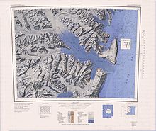
Moubray Bay
It was discovered in 1841 by Sir James Clark Ross and named by him for George H. Moubray, clerk in charge of the expedition ship Terror.
To the west of Cape Roget the Moubray Glacier flows south to the bay from the Adare Saddle.
Named by the US-ACAN for Airman Kelly Slone, USAF, who perished in the crash of a C-154 Globemaster aircraft in this vicinity in 1958.
Steep glacier in the Admiralty Mountains, flowing southeast between Honeycomb Ridge and Quartermain Point into Moubray Bay.
Named by the US-ACAN for Airman 2nd Class Robert L. Burnette, USAF, who perished in a crash of a C-124 Globemaster in this vicinity in 1958.
Glacier which drains the north and east sides of the mountainous mass surmounted by Mount Whewell, then flows south between that feature and Honeycomb Ridge to Moubray Bay.
A glacier flowing from the east slopes of Mount Humphrey Lloyd to enter Edisto Inlet just south of Luther Peak, in Victoria Land.
Glacier flowing northeast between Felsite Island and Redcastle Ridge into the head of Edisto Inlet.
Ridge which extends north from the mouth of Ironside Glacier on the west side of Moubray Bay.
So named by the NZGSAE, 1957-58, because it consists mainly of a granitic rock which in many places is honeycombed on exposed surfaces by holes and cavities.
Small cove 2 nautical miles (3.7 km; 2.3 mi) north of Helm Point, indenting the east side of Honeycomb Ridge at the west margin of Moubray Bay.
Point which marks the southeast tip of Honeycomb Ridge on the west side of Moubray Bay.
Named by the NZGSAE, 1957-58, for Arthur S. Helm, Secretary, Ross Sea Committee, who gave much assistance to the expedition.
Small, bare granite island, or stack, in Moubray Bay, 1 nautical mile (1.9 km; 1.2 mi) south of Heim Point.
Peak, 820 metres (2,690 ft) high, standing 11 nautical miles (20 km; 13 mi) southeast of Mount Peacock in the Admiralty Mountains and overlooking Edisto Inlet.
Charted from radarscope photographs taken in March 1956 by members of United States Navy OpDFrz I aboard the USS Edisto.
A prominent hill, 1,050 metres (3,440 ft) high, on the north side of Edisto Glacier in the Admiralty Mountainsd.
Its summit is littered with slabs of hard sedimentary rock, many of which are steeply tilted on end to give the appearance of a field of tombstones.
[22] This article incorporates public domain material from websites or documents of the United States Geological Survey.