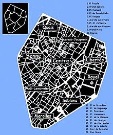
Small Ring, Brussels
This freed up the main tunnels that had contained the water to allow construction of the Brussels premetro (underground tram) service with minimal disruption to the surface.
It is thus possible to drive through tunnels from Brussels-South railway station to the Place Sainctelette/Saincteletteplein (via Arts-Loi/Kunst-Wet) and then on to the Koekelberg Basilica, or vice versa, without traffic light interruption.
The section of the Small Ring between the Place Sainctelette and the South Station via the Anderlecht Gate is completely at surface-level and is thus slower to traverse.
With the return of stability, in 1818, authorities organised a contest for plans to demolish the ramparts and replace them with boulevards suited to the exigencies of contemporary life in the city.
A barrier with a ditch running its length was still installed, however, and toll pavilions built at the entrances, to allow continued taxation of commercial goods entering the city.
In the 1950s, with pressure from the automobile, new plans to improve traffic flow were implemented, partly due to the 1958 Brussels World's Fair (Expo 58).
[1] Later, tunnels were dug, and one of the main lines of the Brussels Metro now runs primarily underneath the Small Ring.
The route N0 formally has its kilometer zero at the Porte de Hal/Hallepoort (in the middle of the tunnel) and then runs in a clockwise fashion back to where it began.
While between Place de l'Yser/IJzerplein and the Antwerp Gate intersection the N0b designation exists for a short section of Boulevard d'Anvers/Antwerpselaan where the N0 has entered the Rogier tunnel.
Finally, the designation N0c was given to a stretch of road connecting the Small Ring to Rue Belliardstraat at the Trône or Troon tunnel (counter-clockwise only).