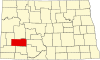
Stark County, North Dakota
[3] Stark County is part of the Dickinson, North Dakota micropolitan area.
It was named for George Stark, a vice president of the Northern Pacific Railroad.
[5][6][7] The south branch of the Heart River flows through the central part of Stark County, discharging into Patterson Lake at Dickinson, then flowing east-southeasterly into adjacent Morton County.
The county terrain consists of semi-arid rolling hills, mostly devoted to agriculture.
[8] The terrain slopes to the east, with its highest point near its SW corner, at 2,831 ft (863 m) ASL.
[10] The southwestern counties of North Dakota (Adams, Billings, Bowman, Golden Valley, Grant, Hettinger, Slope, Stark) observe Mountain Time.
[2] The top five reported ancestries (people were allowed to report up to two ancestries, thus the figures will generally add to more than 100%) were English (92.2%), Spanish (3.7%), Indo-European (1.8%), Asian and Pacific Islander (1.1%), and Other (1.2%).
In terms of ancestry, 59.0% were German, 14.7% were Norwegian, 7.7% were Russian, 7.7% were Irish, 7.3% were Czech, 5.4% were English, and 3.5% were American.
In no national election since 1964 has the county selected the Democratic Party candidate (as of 2024).
Despite its rapid population growth due to a massive oil boom, Stark County has swung right faster than almost any county, with oil-friendly Republican candidate Donald Trump collapsing Democratic support in 2016 by almost 10% and increasing Republican margins to 79%, the highest since Eisenhower in 1952.