California State Water Project
[2][3][4] The SWP collects water from rivers in Northern California and redistributes it to the water-scarce but populous cities through a network of aqueducts, pumping stations and power plants.
[6] The SWP shares many facilities with the federal Central Valley Project (CVP), which primarily serves agricultural users.
[7] Since its inception in 1960, the SWP has required the construction of 21 dams and more than 700 miles (1,100 km) of canals, pipelines and tunnels,[8] although these constitute only a fraction of the facilities originally proposed.
The project was intended for "the control, protection, conservation, distribution, and utilization of the waters of California, to meet present and future needs for all beneficial uses and purposes in all areas of the state to the maximum feasible extent.
Historians largely attribute the success of the Burns-Porter Act and the State Water Project to major agribusiness lobbying, particularly by J.G.
[21] A Peripheral Canal, which would have carried SWP water around the vulnerable and ecologically sensitive Sacramento–San Joaquin River Delta, was rejected in 1982 due to environmental concerns.
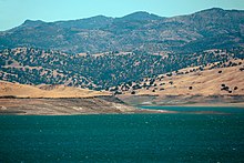
Collectively referred to as the Upper Feather River Lakes, these three reservoirs provide a combined storage capacity of about 162,000 acre-feet (0.200 km3).
San Luis Reservoir is shared by the SWP and the federal Central Valley Project; here water can be switched between the California Aqueduct and Delta-Mendota Canal to cope with fluctuating demands.
[37] South of the San Luis Reservoir complex, the aqueduct steadily gains elevation through a series of massive pumping plants.
Dos Amigos Pumping Plant is located shortly south of San Luis, lifting the water 118 feet (36 m).
Buena Vista, Teerink and Chrisman Pumping Plants are located on the main aqueduct near the southern end of the San Joaquin Valley near Bakersfield.
The aqueduct then reaches A.D. Edmonston Pumping Plant, which lifts the water 1,926 feet (587 m) over the Tehachapi Mountains that separate the San Joaquin Valley from Southern California.
[24] The Coastal Branch diverts about 48,000 acre⋅ft (0.059 km3) per year from the California Aqueduct to parts of San Luis Obispo and Santa Barbara counties.
[39] Pumping plants at Las Perillas, Badger Hill, Devil's Den, Bluestone, and Polonio Pass serve to lift the water over the California Coast Ranges.
[42] From the terminus of the main California Aqueduct at Tehachapi Afterbay, the West Branch carries water to a second reservoir, Quail Lake, via the Oso Pumping Plant.
The water then runs south by gravity to the 78 MW William E. Warne Powerplant, located on the 180,000 acre⋅ft (0.22 km3) Pyramid Lake reservoir.
Together, Pyramid and Castaic Lakes form the primary storage for West Branch water delivered to Southern California.
[45] The East Branch principally provides water for cities and farms in the Inland Empire, Orange County, and other areas south of Los Angeles.
[50] Although most of the proposed projects met their demise over political squabbles, one that persisted was the Dos Rios Project on the Eel River system, which would have involved constructing a gigantic dam on the Middle Fork of the Eel River, diverting water through the Grindstone Tunnel into the Sacramento Valley.
[53] The Klamath and Dos Rios diversions were heavily opposed by local towns and Native American tribes, whose land would have been flooded under the reservoirs.
[56] California WaterFix, is a planned twin forty-foot (12 m) tunnel project that would extend through the center of the Delta, 150 feet (46 m) below ground.
Supporters of the canal and tunnel have included the Central Valley farmers and the Metropolitan Water District and urban developers in Los Angeles.
[58] Governor Jerry Brown had supported a ballot initiative approving the canal in the early 1980s, and stated his intention to finish the project in its tunnel form during his second governorship (2011–2019).
Water "skimmed" off high winter flows in the Sacramento River would be pumped into a storage basin in the western side of the valley known as Sites Reservoir.
[64] However, the project has been criticized for its high cost, and potential disruption of fish migration when large amounts of water are drawn from the Sacramento River during the wet season.
Stage II, which includes such works as the Peripheral Canal and Sites Reservoir, was to have been built beginning in the late 1970s and 1980s – but due to concerted opposition from Northern Californians, environmentalist groups and some economic interests, as well as the state's increasing debt, attempts to begin construction have all met with failure.
As a result, SWP capacity falls short by an average of 2 million acre-feet (2.5 km3) each year; contractors only occasionally receive their full shares of water.
As the Banks Pumping Plant pulls water from the Sacramento River southward across the Delta, it disrupts the normal flow direction of east to west that salmon smolt follow to the Pacific Ocean.
Populations of salmon and steelhead trout have reached critically low levels in the decades after SWP water withdrawals began.
The fish migration issue has become hotly contested in recent years, with rising support for the construction of the Peripheral Canal, which would divert water around the Delta, restoring the natural flow direction.