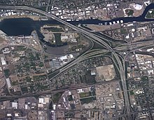
Stockton Channel
The Mormon Slough branches off the Stockton Channel to the Southeast.
[1][2][3][4][5][6] The Stockton Channel overflowed its banks in the great flood of 1955.
San Joaquin County was named a federal disaster area.
[7][8] United States Army Corps of Engineers performs annual maintenance on the Stockton Channel, which includes dredging to remove silt.
[9] A dam on Mormon Slough was built to stop flooding and silt build up in the Stockton Channel.