Sudetes
They stretch from the Saxon capital of Dresden in the northwest across to the region of Lower Silesia in Poland and to the Moravian Gate in the Czech Republic in the east.
[1] Its plateaus and subtle summit relief makes the Sudetes more akin to mountains of Northern Europe than to the Alps.
The highest parts of the Sudetes are protected by national parks;[2] Karkonosze and Stołowe (Table) in Poland and Krkonoše in the Czech Republic.
[2] Due to logging in the last centuries little remains of the broad-leaf trees like beech, sycamore, ash and littleleaf linden that were once common in the Sudetes.
[6] Some spruce plantations have suffered severe damage as the seeds used came from lowland specimens that were not adapted to mountain conditions.
[2] Silver fir grow naturally in the Sudetes being more widespread in past times, before clearance since the Late Middle Ages and subsequent industrial pollution reduced the stands.
[7] Many arctic-alpine and alpine vascular plants have a disjunct distribution being notably absent from the central Sudetes despite suitable habitats.
Possibly this is the result a warm period during the Holocene (last 10,000 years) which wiped out cold-adapted vascular plants in the medium-sized mountains of the central Sudetes where there was no higher ground that could serve as refugia.
[8] Other alpine plants such as Cardamine amara, Epilobium anagallidifolium, Luzula sudetica and Solidago virgaurea occur beyond their altitudinal zonation in very humid areas.
[5] Mountains rise considerably above the timber line, at most 400 m, a characteristic that sets the Sudetes apart from other Mittelgebirge of Central Europe.
[13] The granites and grantic-gneisses of Izera in the west Sudetes are disassociated from orogeny and thought to have formed during rifting along a passive continental margin.
[17][D] The Karkonosze Granite, also in the west Sudetes, have been dated to have formed c. 318 million years ago at the beginning of the Variscan orogeny.
[21] These pyroxenite xenoliths arrived to surface from approximate depths of 35, 70 and 73 km and indicate a complex history for the mantle beneath the Sudetes.
[24] The mountains took their present form after the Late Mesozoic retreat of the seas from the area which left the Sudetes subject to denudation for at least 65 million years.
[26] Uplift was accomplished by the creation or reactivation of numerous faults leading to a reshaping of the relief by renewed erosion.
[23] Some of the landforms present are escarpments, inselbergs, bornhardts, granitic domes, tors, flared slopes and weathering pits.
The relative influence of Pliocene-Quaternary tectonic movements and erosion in shaping the mountain landscape may vary along the northern front of the Sudetes.
[9] The occurrence or not of these periglacial landforms depends on altitude, the steepness and direction of slopes and the underlying rock type.
[2] Destruction and degradation of the Sudetes forest peaked in the 16th and 17th centuries[7] with demand of firewood coming from glasshouses that operated through the area in the early modern period.
[2] In the 19th century the Central Sudetes had an economic boom with sandstone quarrying and a flourishing tourism industry centered on the natural scenery.
[29] Industrial activity across Europe has caused considerable damage to the forests as acid rain and heavy metals has arrived with westerly and southwesterly winds.
[7] After World War I, the name Sudetenland came into use to describe areas of the First Czechoslovak Republic with large ethnic German populations.
In 1918, the short-lived rump state of German-Austria proclaimed a Province of the Sudetenland in northern Moravia and Austrian Silesia around the city of Opava (Troppau).
Sparking the Sudeten Crisis, Adolf Hitler got his future enemies Britain and France to concede the Sudetenland with most of the Czechoslovak border fortifications in the 1938 Munich Agreement, leaving the remainder of Czechoslovakia shorn of its natural borders and buffer zone, finally occupied by Germany in March 1939.
After World War II, most of the previous population of the Sudetes was forcibly expelled on the basis of the Potsdam Agreement and the Beneš decrees, and the region was resettled by new Polish and Czechoslovak citizens.
[30] As of 2000 scholar Krzysztof R. Mazurski judged that the Sudetes, much like Poland's Baltic coast and the Carpathians, were unlikely to attract much foreign tourism.
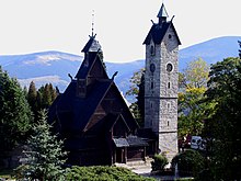
[31] Sandstone labyrinths have been a notable tourist attraction since the 19th century with considerable investments being done in projecting trails some of which involve rock engineering.