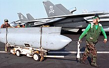
Tactical Airborne Reconnaissance Pod System
Tomcat TARPS squadrons were staffed with Navy photographer's mates and Avionics Technicians that maintained the cameras and worked with the carrier to process the imagery.
As a result, the first set of four KA-93 910 mm (36") focal length Long Range Optic (LOROP) cameras were shipped to Naval Air Station Oceana in the spring of 1984 for deployment with the next Tomcat TARPS squadron.
The KS-87 camera bay was eventually upgraded with a digital sensor so that imagery could be captured onto a PCMCIA Type II card for debrief, but could also be transmitted as desired by the RIO.
Prior to that, some Tomcat squadrons used modified "Fuzz-buster" automotive police radar detectors mounted ad hoc on the pilot's glare shield to detect threats not handled by the ALR-45/50.
[2] TARPS was immediately impressed into the Cold War and used for surveillance of Soviet ships at sea and in their anchorages sometimes from over 1,000 miles (1,600 km) distant from patrolling aircraft carriers in the classic cat and mouse tactics of that era.
VF-102 Tomcats had been inadvertently been fired on by AAA and a single SA-2 SAM over Somalia in April 1983 while conducting peacetime mapping prior to a major exercise.
Thus, TARPS was responsible for the Tomcat's first sustained combat baptism of fire when the crisis in Lebanon heated up in 1983 requiring daily overflights over hostile AAA and SAMs.
During operation El Dorado Canyon in 1986, Libya launched SCUD missiles at a US outpost on an island in the Mediterranean and VF-102 flew TARPS to ascertain if there had been any damage.
Initially, TARPS was not a priority on the air tasking order during Desert Shield/Storm due to availability of strategic assets like the U-2/TR-1 and plentiful USAF RF-4 units.
Immediately, it became obvious that Tomcats were favored for in country missions over the RF-4 as they required no escort and needed less fuel pre- and post-mission, which was a real concern at the time.
The Federal Emergency Management Agency (FEMA) requested TARPS flights be taken over the area to determine which locations were hardest hit.