Temagami Greenstone Belt
It represents a feature of the Superior craton, an ancient and stable part of the Earth's lithosphere that forms the core of the North American continent and Canadian Shield.
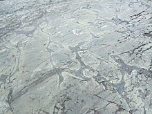
The belt is made up of a number of geologic features such as batholiths, stocks, dikes, volcanic complexes, layered intrusions and deformation zones.
[5] It contains the southernmost remnants of Archean intrusive and supracrustal rocks in Eastern Ontario, as well as some of the most ancient felsic magmatic events in this section of the Superior craton.
The iron formations are composed of alternate layers of magnetite, white quartzite, jasper, grey cherty quartz, and/or tremolite-chlorite tuff.
It shears through the nearby fold axis of the Tetapaga Syncline, but remains undeformed by the western expression of the Net Lake-Vermilion Lake Deformation Zone.
[14] Volcanic vents composed of felsic rocks are thought to have been located at the iron-bearing Sherman Mine, the former Temagami garbage dump and adjacent to the Milne Townsite.
The aspect of the most extensive felsic lava flow indicates that the volcanic vent they erupted from was adjacent to the western portion of Link Lake.
An igneous body, interpreted to be a subvolcanic intrusion, is exposed approximately 1 km (0.62 mi) to the northwest and might have formed during the same magmatic event as the felsic dome.
These dikes are not known to extend across the Link Lake Deformation Zone, suggesting that they might represent the feeders of a minor volcanic vent, manifest now by felsic lava flows.
Dark green subaerial pyroclastics composed of chlorite and sericite are uncommon and have sustained preferential compression in response to shear throughout the Link Lake Deformation Zone.
Some of the subsequence pyroclastic deposits contain fragments of pyrite and quartz, suggesting that discharged sulfide hydrothermal activity took place throughout the volcanic source area.
Many dark green, highly vesicular, iron-rich tholeiitic basalts occur in the Turtle Lake Formation, and are interbedded with thin-bedded wackes on the southern limb of the Tetapaga Syncline.
Evidence for early tectonism, likely related to volcanic activity, include the greater density of felsic dikes concentrated immediately around these zones.
Renewed tectonic activity along the Big Dan Shear Zone is manifested by offset of clastic sediments east of the Ontario Northland Railway.
Also exposed in this area is a dark yellow 40 cm (16 in) wide quartz vein composed of pyrite that cross cuts the iron formation at the northeastern end.
The South and East Pit iron formations reach thicknesses of 30 m (98 ft) and overlie a thinly bedded turbidite package on the southern limb of the Tetapaga Syncline.
This large landmass consisted of the Baltic and Siberian shields of Eurasia and Archean provinces of North America, including the Superior craton of which the Temagami belt occupies a part.
Final breakup formed a large group of mafic dike and sill swarms in the North American provinces 2.2–2.1 billion years ago.
[19] By the Paleoproterozoic era Kenorland had already rifted apart, and the TGB formed a small part of the supercontinent Columbia starting 1.9–1.8 billion years ago.
Eastern India, Australia, Laurentia, Baltica, North China, the Amazon shield and portions of Antarctica formed the landmass until it ruptured 1.5–1.4 billion years ago.
This former supercontinent, known as Rodinia, included Oaxaquia, Rockall, Laurentia, Baltica, Australia, West Africa, South China, Amazonia, Mawson and Río de la Plata cratons, as well as the Pampean terrane.
[26] Subsequently, Baltica, Laurenta and microcontinent Avalonia collided in the Devonian period (416-359 million years ago) to form the continent Euramerica.
[18][33] Nevertheless, the original spelling (Timagami) has appeared in documents published after the renaming, including Kent C. Condie's 1981 book Archean Greenstone Belts.
[34] In May 1995 Pacific Mariner Exploration carried out a small drilling program on its properties in Strathy Township to estimate the likelihood of base metal deposits.
Several holes were drilled and intersected mostly mafic to intermediate volcanic rocks and areas of stringer sulfides with pyrrhotite, pyrite and some chalcopyrite.
With the existence of Early Archean age tholeiitic and/or calc-alkaline mafic to intermediate volcanic rocks, they may represent a minor continuation of the belt, which is located about 6 km (3.7 mi) to the southwest.
The core of a widespread massive sulfide deposit composed of palladium, nickel, copper, gold, cobalt, platinum and silver was mined out from underground and by an open pit from 1934 to 1936.
The high-grade copper deposit in which the mine extracted was discovered by Canadian geophysicist Norman Bell Keevil (1910–1989) in the mid-20th century during testing of a newly established airborne metal detector.
In February 1992, Deak Resources completed diamond drilling and bulk sampling at the mine and 3,000 tons of rock was shipped to its Kerr Mill in Virginiatown.
[15] About 1 km (0.62 mi) north of Beanland lies the abandoned Hermiston-McCauley Mine, situated on the northwestern side of the Net Lake-Vermilion Lake Deformation Zone.