Tennessee State Route 19
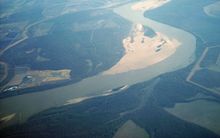
[1] The Mississippi River valley with flood plains and bluffs, the rolling hills of Tennessee and cotton fields dominate the rural landscape of the area traversed by SR 19.
State Route 19 is located on the southeastern edge of the New Madrid Seismic Zone, an area with a high earthquake risk.
The first several miles of SR 19 traverse the Mississippi River valley with expansive flood plains and large farmland.
SR 19 ascends a steep bluff and traverses the rolling hills of West Tennessee as it continues east through Ripley, Nutbush and Brownsville to reach its eastern terminus at I-40.
It continues east, through the bluffs, then passing low cotton fields and hills until it reaches Ripley, also in Lauderdale County.
State Route 19 is situated on the southeastern edge of the New Madrid Seismic Zone, an area with a high earthquake risk.
Modern machines like the cotton picker have made the manual cultivation obsolete over time as they took over the work from the hand laborers.
Lagoon Creek Peaking Facility is run by the Tennessee Valley Authority (TVA) in Nutbush not far from State Route 19.
[10][11] The early black and white musicians and singers from the Nutbush churches along today's State Route 19 recorded and influenced an international audience.
Nutbush is the birthplace and home community of black and white pioneer musicians and prominent recording artists such as Hambone Willie Newbern and Sleepy John Estes.
In 2002, Tennessee State Route 19 between Nutbush and Brownsville was officially designated "Tina Turner Highway" in honor of the singer.
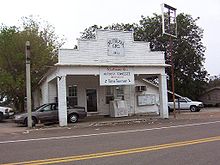
[8] Trinity United Methodist Church, founded in 1822, is located just south of Nutbush, along old State Route 19.