Thonburi
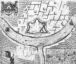
During the era of the Kingdom of Ayutthaya, its location on the right (west) bank at the mouth of the Chao Phraya River had made it an important garrison town, which is reflected in its name: thon (ธน) a loanword from Pali dhána 'wealth', and buri (บุรี), from púra, 'fortress'.
[2] The full formal name was Thon Buri Si Mahasamut (กรุงธนบุรีศรีมหาสมุทร 'City of Treasures Gracing the Ocean').
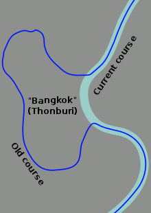
Rama I, the newly enthroned king, moved the capital across the river, where stakes driven into the soil of Bangkok for the City Pillar at 06:45 on 21 April 1782 marked the official founding of the new capital.
Many of the traditional small waterways, khlongs, still exist there, while they are nearly gone from the other side of the river.
At the time of the merger, Thonburi province consisted of nine districts (amphoe).