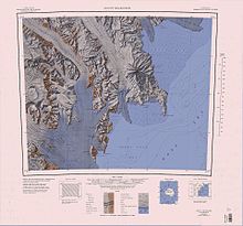
Nash Ridge
The Southern Party of the New Zealand Geological Survey Antarctic Expedition (NZGSAE) (1962-63) gave this name because petrified sections of tree branches were found in sandstone deposits at this point.
A large mountain, 2,890 metres (9,480 ft) high, standing immediately northwest of Nash Ridge on the south side of Priestley Glacier.
A mountain, 2,520 metres (8,270 ft) high, on the west side of Priestley Glacier, surmounting the north end of Nash Ridge.
A mountain, 2,610 metres (8,560 ft) high, rising 2 nautical miles (3.7 km; 2.3 mi) southeast of Mount Meister on Nash Ridge.
A flat-topped, steep-sided promontory which protrudes from the east side of Eisenhower Range and forms the north wall of O'Kane Canyon.
So named by the Southern Party of NZGSAE, 1962-63, which camped on its upper surface and built an igloo while waiting for white-out conditions to lift.